Pueblo Viejo geodata
Pueblo Viejo (Tabasco) is a populated place; located in Mexico in America/Mexico_City (GMT-6) time zone. With population of 1,105 people, there are 7868 cities with bigger population in this country. Compared to other cities in Mexico, 76.2% of cities are located further ↑North; 88.2% of cities are located further ←West and 97% of cities have higher elevation than Pueblo Viejo. Note1


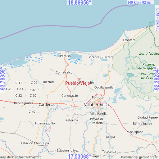
Pueblo Viejo GPS coordinates[2]
18° 11' 59.64" North, 93° 5' 7.656" West
| Map corner | latitude | longitude |
|---|---|---|
| Upper-left | 18.86656°, | -93.78859° |
| Center: | 18.1999°, | -93.08546° |
| Lower-right: | 17.53068°, | -92.38234° |
| Map W x H: | 148.5×148.5 km | = 92.3×92.3mi |
| max Lat: | 32.7° ⇑76.2% North |
| Pueblo Viejo: | 18.1999° |
| min Lat: | ⇓23.8% South 14.53588° |
| min Long | Pueblo Viejo | max Long |
| -117.105° | -93.08546° | -86.73105° |
| W 88.2%⇐ | ⇒11.8% E |
Elevation
Elevation of Pueblo Viejo is 10 m = 33 ft, and this is 1243.7 m = 4080 ft below average elevation for this country.
| Max E: |
3497 m = 11473 ft | 97% |
| Avg. | 1253.7 m = 4113 ft | |
| Pueblo Viejo | 10 m = 33 ft | |
Min E: |
-1 m = -3 ft | 3% |
See also: Mexico elevation on elevation.city.
Geographical zone
Pueblo Viejo is located in North Torrid zone (between Equator and Tropic of Cancer). Distance of this Northern Tropic circle is 582.3 km =361.8 mi to North.| Distance of | km | miles | from Pueblo Viejo |
|---|---|---|---|
| North Pole | 7983.4 | 4960.7 | to North |
| Arctic Circle | 5377.5 | 3341.4 | to North |
| Tropic Cancer | 582.3 | 361.8 | to North |
| Equator | 2023.6 | 1257.4 | to South |


Nearby cities:
15 places around Pueblo Viejo: (largest is in red/bold)
• Ayapa
3.9 km =2.4 mi,  314°
314°
• Cupilco
6.3 km =3.9 mi, 314°
• El Novillero
5.7 km =3.5 mi,  352°
352°
• Gregorio Méndez
1.8 km =1.1 mi,  257°
257°
• Guaytalpa
5.9 km =3.7 mi,  71°
71°
• Hermenegildo Galeana 2da. Sección
6.2 km =3.9 mi,  238°
238°
• Iquinuapa
3.7 km =2.3 mi, 263°
• Jalpa de Méndez
3.5 km =2.2 mi,  137°
137°
• La Ensenada
3 km =1.9 mi, 353°
• La Pera
5.5 km =3.4 mi,  223°
223°
• La Trinidad
4.3 km =2.7 mi,  17°
17°
• Mecoacán
4.3 km =2.7 mi,  5°
5°
• Nicolás Bravo
5 km =3.1 mi,  177°
177°
• Novillero 4ta. Sección
5.9 km =3.7 mi,  328°
328°
• Soyataco
1.6 km =1 mi,  46°
46°
Sources, notices
• [Note1] Compared only with cities in Mexico existing in our database
• [Src1] Map data: © OpenStreetMap contributors (CC-BY-SA)
• [Src2] Other city data from geonames.org with taken over terms of usage.
• [Src3] Geographical zone / Annual Mean Temperature by Robert A. Rohde @ Wikipedia
