La Pera geodata
La Pera (Tabasco) is a populated place; located in Mexico in America/Mexico_City (GMT-6) time zone. With population of 538 people, there are 15775 cities with bigger population in this country. Compared to other cities in Mexico, 76.6% of cities are located further ↑North; 88% of cities are located further ←West and 97% of cities have higher elevation than La Pera. Note1


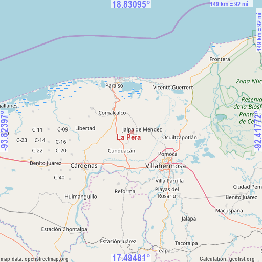
La Pera GPS coordinates[2]
18° 9' 50.976" North, 93° 7' 15.024" West
| Map corner | latitude | longitude |
|---|---|---|
| Upper-left | 18.83095°, | -93.82397° |
| Center: | 18.16416°, | -93.12084° |
| Lower-right: | 17.49481°, | -92.41772° |
| Map W x H: | 148.6×148.6 km | = 92.3×92.3mi |
| max Lat: | 32.7° ⇑76.6% North |
| La Pera: | 18.16416° |
| min Lat: | ⇓23.4% South 14.53588° |
| min Long | La Pera | max Long |
| -117.105° | -93.12084° | -86.73105° |
| W 88%⇐ | ⇒12% E |
Elevation
Elevation of La Pera is 10 m = 33 ft, and this is 1243.7 m = 4080 ft below average elevation for this country.
| Max E: |
3497 m = 11473 ft | 97% |
| Avg. | 1253.7 m = 4113 ft | |
| La Pera | 10 m = 33 ft | |
Min E: |
-1 m = -3 ft | 3% |
See also: Mexico elevation on elevation.city.
Geographical zone
La Pera is located in North Torrid zone (between Equator and Tropic of Cancer). Distance of this Northern Tropic circle is 586.3 km =364.3 mi to North.| Distance of | km | miles | from La Pera |
|---|---|---|---|
| North Pole | 7987.4 | 4963.1 | to North |
| Arctic Circle | 5381.5 | 3343.9 | to North |
| Tropic Cancer | 586.3 | 364.3 | to North |
| Equator | 2019.7 | 1255 | to South |


Nearby cities:
15 places around La Pera: (largest is in red/bold)
• Anta
6.3 km =3.9 mi,  194°
194°
• Ayapa
6.7 km =4.2 mi,  8°
8°
• Boquiapa
1.8 km =1.1 mi,  259°
259°
• Cúlico 2da. Sección
2.8 km =1.7 mi,  205°
205°
• El Carmen
6.5 km =4 mi,  329°
329°
• Gregorio Méndez
4.1 km =2.5 mi,  28°
28°
• Hermenegildo Galeana 2da. Sección
1.7 km =1.1 mi,  295°
295°
• Huapacal 2da. Sección (Punta Brava)
6.5 km =4 mi, 304°
• Huimango 1ra. Sección (El Dren)
6.1 km =3.8 mi, 213°
• Iquinuapa
3.5 km =2.2 mi,  0°
0°
• Jalpa de Méndez
6.3 km =3.9 mi,  77°
77°
• Nicolás Bravo
4.1 km =2.5 mi,  104°
104°
• Pueblo Viejo
5.5 km =3.4 mi,  43°
43°
• San Hipólito
5 km =3.1 mi,  181°
181°
• Santa Lucía
6.7 km =4.2 mi,  168°
168°
Sources, notices
• [Note1] Compared only with cities in Mexico existing in our database
• [Src1] Map data: © OpenStreetMap contributors (CC-BY-SA)
• [Src2] Other city data from geonames.org with taken over terms of usage.
• [Src3] Geographical zone / Annual Mean Temperature by Robert A. Rohde @ Wikipedia
