Hueso de Puerco geodata
Hueso de Puerco (Tabasco) is a populated place; located in Mexico in America/Mexico_City (GMT-6) time zone. With population of 639 people, there are 13559 cities with bigger population in this country. Compared to other cities in Mexico, 80.6% of cities are located further ↑North; 89.2% of cities are located further ←West and 93.5% of cities have higher elevation than Hueso de Puerco. Note1


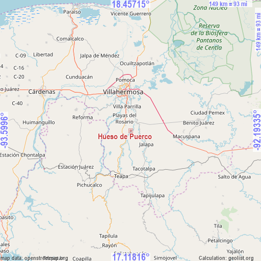
Hueso de Puerco GPS coordinates[2]
17° 47' 20.076" North, 92° 53' 47.292" West
| Map corner | latitude | longitude |
|---|---|---|
| Upper-left | 18.45715°, | -93.5996° |
| Center: | 17.78891°, | -92.89647° |
| Lower-right: | 17.11816°, | -92.19335° |
| Map W x H: | 148.9×148.9 km | = 92.5×92.5mi |
| max Lat: | 32.7° ⇑80.6% North |
| Hueso de Puerco: | 17.78891° |
| min Lat: | ⇓19.4% South 14.53588° |
| min Long | Hueso de Puerco | max Long |
| -117.105° | -92.89647° | -86.73105° |
| W 89.2%⇐ | ⇒10.8% E |
Elevation
Elevation of Hueso de Puerco is 16 m = 52 ft, and this is 1237.7 m = 4061 ft below average elevation for this country.
| Max E: |
3497 m = 11473 ft | 93.5% |
| Avg. | 1253.7 m = 4113 ft | |
| Hueso de Puerco | 16 m = 52 ft | |
Min E: |
-1 m = -3 ft | 6.5% |
See also: Mexico elevation on elevation.city.
Geographical zone
Hueso de Puerco is located in North Torrid zone (between Equator and Tropic of Cancer). Distance of this Northern Tropic circle is 628 km =390.2 mi to North.| Distance of | km | miles | from Hueso de Puerco |
|---|---|---|---|
| North Pole | 8029.1 | 4989 | to North |
| Arctic Circle | 5423.2 | 3369.8 | to North |
| Tropic Cancer | 628 | 390.2 | to North |
| Equator | 1977.9 | 1229 | to South |


Nearby cities:
15 places around Hueso de Puerco: (largest is in red/bold)
• Astapa
5.1 km =3.2 mi,  99°
99°
• El Rosario y el Quemado
11.9 km =7.4 mi,  347°
347°
• Emiliano Zapata
5.2 km =3.2 mi,  109°
109°
• Francisco J. Santamaría (Cacao)
5.9 km =3.7 mi,  44°
44°
• Jahuacapa
8.9 km =5.5 mi,  129°
129°
• Jalapa
11.6 km =7.2 mi, 130°
• La Lima
14.1 km =8.8 mi,  343°
343°
• Manuel Buelta y Rayón
11.2 km =7 mi,  213°
213°
• Parilla
14.2 km =8.8 mi, 351°
• Parrilla II
10.4 km =6.5 mi, 344°
• Playas del Rosario
8.1 km =5 mi,  332°
332°
• Pueblo Nuevo de las Raíces
6.6 km =4.1 mi,  16°
16°
• Río de Teapa
0.7 km =0.4 mi, 213°
• Santa Cruz Tepate Abajo
14.9 km =9.3 mi,  274°
274°
• Santa Fé
13.8 km =8.6 mi,  355°
355°
Sources, notices
• [Note1] Compared only with cities in Mexico existing in our database
• [Src1] Map data: © OpenStreetMap contributors (CC-BY-SA)
• [Src2] Other city data from geonames.org with taken over terms of usage.
• [Src3] Geographical zone / Annual Mean Temperature by Robert A. Rohde @ Wikipedia
