Parrilla II geodata
Parrilla II (Tabasco) is a populated place; located in Mexico in America/Mexico_City (GMT-6) time zone. With population of 10,967 people, there are 869 cities with bigger population in this country. Compared to other cities in Mexico, 79.9% of cities are located further ↑North; 89.1% of cities are located further ←West and 95.1% of cities have higher elevation than Parrilla II. Note1


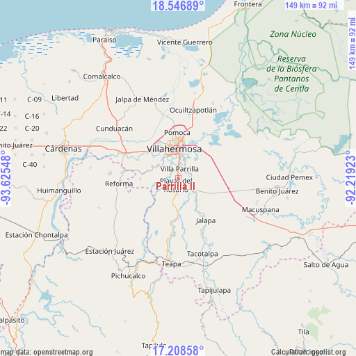
Parrilla II GPS coordinates[2]
17° 52' 44.4" North, 92° 55' 20.46" West
| Map corner | latitude | longitude |
|---|---|---|
| Upper-left | 18.54689°, | -93.62548° |
| Center: | 17.879°, | -92.92235° |
| Lower-right: | 17.20858°, | -92.21923° |
| Map W x H: | 148.8×148.8 km | = 92.5×92.5mi |
| max Lat: | 32.7° ⇑79.9% North |
| Parrilla II: | 17.879° |
| min Lat: | ⇓20.1% South 14.53588° |
| min Long | Parrilla II | max Long |
| -117.105° | -92.92235° | -86.73105° |
| W 89.1%⇐ | ⇒10.9% E |
Elevation
Elevation of Parrilla II is 13 m = 43 ft, and this is 1240.7 m = 4071 ft below average elevation for this country.
| Max E: |
3497 m = 11473 ft | 95.1% |
| Avg. | 1253.7 m = 4113 ft | |
| Parrilla II | 13 m = 43 ft | |
Min E: |
-1 m = -3 ft | 4.9% |
See also: Mexico elevation on elevation.city.
Geographical zone
Parrilla II is located in North Torrid zone (between Equator and Tropic of Cancer). Distance of this Northern Tropic circle is 618 km =384 mi to North.| Distance of | km | miles | from Parrilla II |
|---|---|---|---|
| North Pole | 8019.1 | 4982.8 | to North |
| Arctic Circle | 5413.2 | 3363.6 | to North |
| Tropic Cancer | 618 | 384 | to North |
| Equator | 1988 | 1235.3 | to South |


Nearby cities:
15 places around Parrilla II: (largest is in red/bold)
• El Rosario y el Quemado
1.6 km =1 mi,  4°
4°
• Francisco J. Santamaría (Cacao)
9 km =5.6 mi,  129°
129°
• Gaviotas Sur (El Cedral)
9 km =5.6 mi,  21°
21°
• Huapinol
5 km =3.1 mi,  13°
13°
• Hueso de Puerco
10.4 km =6.5 mi,  164°
164°
• La Lima
3.7 km =2.3 mi,  340°
340°
• Pablo L. Sidar
11.5 km =7.1 mi,  281°
281°
• Parilla
4.1 km =2.5 mi, 9°
• Playas del Rosario
3.1 km =1.9 mi,  199°
199°
• Plutarco Elías Calles (Cura Hueso)
9.6 km =6 mi, 1°
• Pueblo Nuevo de las Raíces
5.9 km =3.7 mi, 129°
• Río Viejo Primera Sección
9.1 km =5.7 mi,  317°
317°
• Río de Teapa
10.9 km =6.8 mi,  167°
167°
• Santa Fé
4.1 km =2.5 mi,  25°
25°
• Villahermosa
12 km =7.5 mi,  355°
355°
Sources, notices
• [Note1] Compared only with cities in Mexico existing in our database
• [Src1] Map data: © OpenStreetMap contributors (CC-BY-SA)
• [Src2] Other city data from geonames.org with taken over terms of usage.
• [Src3] Geographical zone / Annual Mean Temperature by Robert A. Rohde @ Wikipedia
