La Lagunita geodata
La Lagunita (Hidalgo) is a populated place; located in Mexico in America/Mexico_City (GMT-6) time zone. With population of 503 people, there are 16722 cities with bigger population in this country. Compared to other cities in Mexico, 71% of cities are located further ↓South; 53.5% of cities are located further →East and 95.6% of cities have lower elevation than La Lagunita. Note1


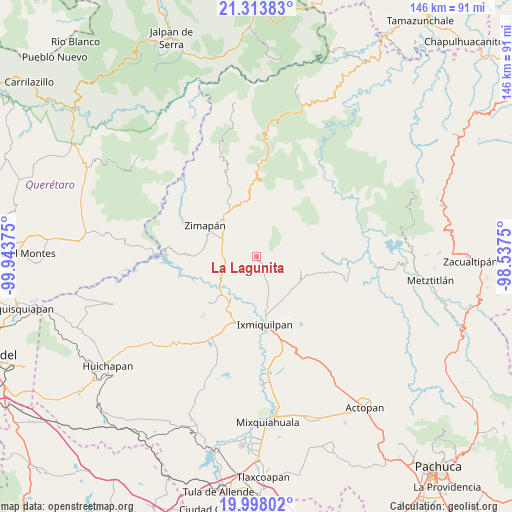
La Lagunita GPS coordinates[2]
20° 39' 26.46" North, 99° 14' 26.232" West
| Map corner | latitude | longitude |
|---|---|---|
| Upper-left | 21.31383°, | -99.94375° |
| Center: | 20.65735°, | -99.24062° |
| Lower-right: | 19.99802°, | -98.5375° |
| Map W x H: | 146.3×146.3 km | = 90.9×90.9mi |
| max Lat: | 32.7° ⇑29% North |
| La Lagunita: | 20.65735° |
| min Lat: | ⇓71% South 14.53588° |
| min Long | La Lagunita | max Long |
| -117.105° | -99.24062° | -86.73105° |
| W 46.5%⇐ | ⇒53.5% E |
Elevation
Elevation of La Lagunita is 2612 m = 8570 ft, and this is 1358.3 m = 4456 ft above average elevation for this country.
| Max E: |
3497 m = 11473 ft | 4.4% |
| La Lagunita | 2612 m 8570 ft | |
| Avg. | 1253.7 m = 4113 ft | |
Min E: |
-1 m = -3 ft | 95.6% |
See also: Mexico elevation on elevation.city.
Geographical zone
La Lagunita is located in North Torrid zone (between Equator and Tropic of Cancer). Distance of this Northern Tropic circle is 309 km =192 mi to North.| Distance of | km | miles | from La Lagunita |
|---|---|---|---|
| North Pole | 7710.2 | 4790.9 | to North |
| Arctic Circle | 5104.3 | 3171.7 | to North |
| Tropic Cancer | 309 | 192 | to North |
| Equator | 2296.9 | 1427.2 | to South |


Nearby cities:
15 places around La Lagunita: (largest is in red/bold)
• Arbolado
13.6 km =8.5 mi,  219°
219°
• Cardonal
13.7 km =8.5 mi,  110°
110°
• El Bingú
12.4 km =7.7 mi,  125°
125°
• El Buena
10.3 km =6.4 mi,  104°
104°
• El Espino
13.1 km =8.1 mi,  150°
150°
• El Espíritu
11 km =6.8 mi,  135°
135°
• El Salitre
11.4 km =7.1 mi,  303°
303°
• Francisco I. Madero
11.7 km =7.3 mi,  315°
315°
• Juchitlán
13.1 km =8.1 mi,  202°
202°
• La Candelaria
12.4 km =7.7 mi,  214°
214°
• Llano Blanco
13.3 km =8.3 mi, 298°
• Los Remedios
13.6 km =8.5 mi,  163°
163°
• Lázaro Cárdenas
10.3 km =6.4 mi, 298°
• Orizabita
8.9 km =5.5 mi, 158°
• San Juanico
13.7 km =8.5 mi,  181°
181°
Sources, notices
• [Note1] Compared only with cities in Mexico existing in our database
• [Src1] Map data: © OpenStreetMap contributors (CC-BY-SA)
• [Src2] Other city data from geonames.org with taken over terms of usage.
• [Src3] Geographical zone / Annual Mean Temperature by Robert A. Rohde @ Wikipedia
