El Salitre geodata
El Salitre (Hidalgo) is a populated place; located in Mexico in America/Mexico_City (GMT-6) time zone. With population of 864 people, there are 10127 cities with bigger population in this country. Compared to other cities in Mexico, 71.9% of cities are located further ↓South; 54.6% of cities are located further →East and 66.6% of cities have lower elevation than El Salitre. Note1


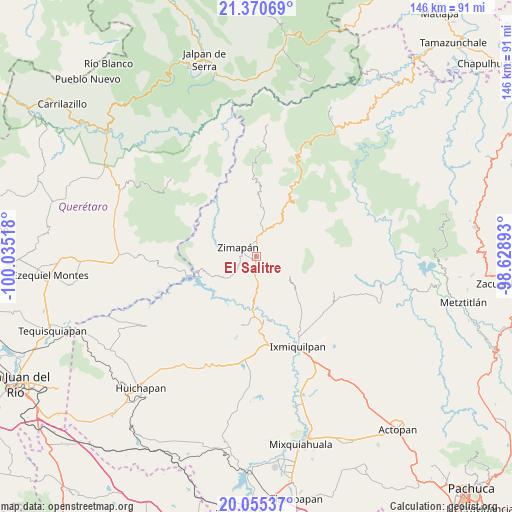
El Salitre GPS coordinates[2]
20° 42' 52.056" North, 99° 19' 55.38" West
| Map corner | latitude | longitude |
|---|---|---|
| Upper-left | 21.37069°, | -100.03518° |
| Center: | 20.71446°, | -99.33205° |
| Lower-right: | 20.05537°, | -98.62893° |
| Map W x H: | 146.2×146.3 km | = 90.8×90.9mi |
| max Lat: | 32.7° ⇑28.1% North |
| El Salitre: | 20.71446° |
| min Lat: | ⇓71.9% South 14.53588° |
| min Long | El Salitre | max Long |
| -117.105° | -99.33205° | -86.73105° |
| W 45.4%⇐ | ⇒54.6% E |
Elevation
Elevation of El Salitre is 1862 m = 6109 ft, and this is 608.3 m = 1996 ft above average elevation for this country.
| Max E: |
3497 m = 11473 ft | 33.4% |
| El Salitre | 1862 m 6109 ft | |
| Avg. | 1253.7 m = 4113 ft | |
Min E: |
-1 m = -3 ft | 66.6% |
See also: Mexico elevation on elevation.city.
Geographical zone
El Salitre is located in North Torrid zone (between Equator and Tropic of Cancer). Distance of this Northern Tropic circle is 302.7 km =188.1 mi to North.| Distance of | km | miles | from El Salitre |
|---|---|---|---|
| North Pole | 7703.8 | 4786.9 | to North |
| Arctic Circle | 5097.9 | 3167.7 | to North |
| Tropic Cancer | 302.7 | 188.1 | to North |
| Equator | 2303.2 | 1431.1 | to South |


Nearby cities:
15 places around El Salitre: (largest is in red/bold)
• Arbolado
16.9 km =10.5 mi,  177°
177°
• Benito Juárez
7.9 km =4.9 mi,  303°
303°
• El Tule
3.6 km =2.2 mi,  311°
311°
• Francisco I. Madero
2.3 km =1.4 mi,  33°
33°
• Juchitlán
19.1 km =11.9 mi,  166°
166°
• La Candelaria
16.7 km =10.4 mi, 171°
• La Lagunita
11.4 km =7.1 mi,  123°
123°
• Llano Blanco
2.2 km =1.4 mi,  271°
271°
• Lázaro Cárdenas
1.5 km =0.9 mi,  161°
161°
• Orizabita
19.4 km =12.1 mi,  138°
138°
• San Isidro
18.7 km =11.6 mi, 177°
• Tasquillo
18.6 km =11.6 mi, 174°
• Tlalpan
3 km =1.9 mi,  276°
276°
• Zimapan
5.8 km =3.6 mi, 296°
• Álvaro Obregón
4.4 km =2.7 mi,  258°
258°
Sources, notices
• [Note1] Compared only with cities in Mexico existing in our database
• [Src1] Map data: © OpenStreetMap contributors (CC-BY-SA)
• [Src2] Other city data from geonames.org with taken over terms of usage.
• [Src3] Geographical zone / Annual Mean Temperature by Robert A. Rohde @ Wikipedia
