Santa Ana Batha geodata
Santa Ana Batha (Hidalgo) is a populated place; located in Mexico in America/Mexico_City (GMT-6) time zone. With population of 1,651 people, there are 5253 cities with bigger population in this country. Compared to other cities in Mexico, 65.2% of cities are located further ↓South; 52.6% of cities are located further →East and 70.9% of cities have lower elevation than Santa Ana Batha. Note1


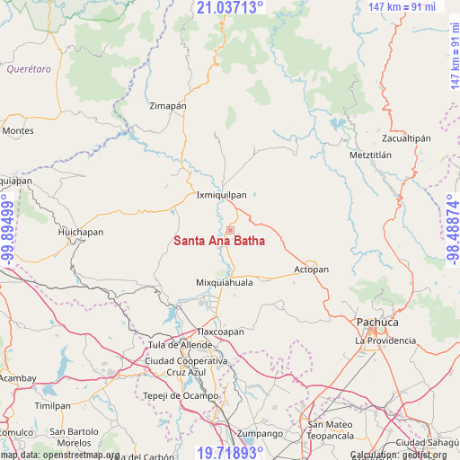
Santa Ana Batha GPS coordinates[2]
20° 22' 45.984" North, 99° 11' 30.696" West
| Map corner | latitude | longitude |
|---|---|---|
| Upper-left | 21.03713°, | -99.89499° |
| Center: | 20.37944°, | -99.19186° |
| Lower-right: | 19.71893°, | -98.48874° |
| Map W x H: | 146.6×146.6 km | = 91.1×91.1mi |
| max Lat: | 32.7° ⇑34.8% North |
| Santa Ana Batha: | 20.37944° |
| min Lat: | ⇓65.2% South 14.53588° |
| min Long | Santa Ana Batha | max Long |
| -117.105° | -99.19186° | -86.73105° |
| W 47.4%⇐ | ⇒52.6% E |
Elevation
Elevation of Santa Ana Batha is 1942 m = 6371 ft, and this is 688.3 m = 2258 ft above average elevation for this country.
| Max E: |
3497 m = 11473 ft | 29.1% |
| Santa Ana Batha | 1942 m 6371 ft | |
| Avg. | 1253.7 m = 4113 ft | |
Min E: |
-1 m = -3 ft | 70.9% |
See also: Mexico elevation on elevation.city.
Geographical zone
Santa Ana Batha is located in North Torrid zone (between Equator and Tropic of Cancer). Distance of this Northern Tropic circle is 339.9 km =211.2 mi to North.| Distance of | km | miles | from Santa Ana Batha |
|---|---|---|---|
| North Pole | 7741.1 | 4810.1 | to North |
| Arctic Circle | 5135.2 | 3190.9 | to North |
| Tropic Cancer | 339.9 | 211.2 | to North |
| Equator | 2266 | 1408 | to South |


Nearby cities:
15 places around Santa Ana Batha: (largest is in red/bold)
• Bethí
4 km =2.5 mi,  297°
297°
• Cañada Chica
5.3 km =3.3 mi,  44°
44°
• Chilcuautla
6.8 km =4.2 mi,  217°
217°
• El Alberto
5.4 km =3.4 mi,  317°
317°
• El Barrido
7.9 km =4.9 mi,  0°
0°
• El Dadho
5.4 km =3.4 mi, 304°
• El Dontzhí (Colonia Álamos)
6.5 km =4 mi,  225°
225°
• El Mejay
1.3 km =0.8 mi,  55°
55°
• El Tablón
4.5 km =2.8 mi, 4°
• El Xothi
3.4 km =2.1 mi, 36°
• La Estancia
2 km =1.2 mi,  306°
306°
• Maguey Blanco
5.4 km =3.4 mi,  24°
24°
• Taxadho
7.4 km =4.6 mi, 36°
• Tlactlapilco
2.8 km =1.7 mi,  262°
262°
• Xuchitlán
4.2 km =2.6 mi,  76°
76°
Sources, notices
• [Note1] Compared only with cities in Mexico existing in our database
• [Src1] Map data: © OpenStreetMap contributors (CC-BY-SA)
• [Src2] Other city data from geonames.org with taken over terms of usage.
• [Src3] Geographical zone / Annual Mean Temperature by Robert A. Rohde @ Wikipedia
