Xuchitlán geodata
Xuchitlán (Hidalgo) is a populated place; located in Mexico in America/Mexico_City (GMT-6) time zone. With population of 832 people, there are 10517 cities with bigger population in this country. Compared to other cities in Mexico, 65.4% of cities are located further ↓South; 51.9% of cities are located further →East and 70.5% of cities have lower elevation than Xuchitlán. Note1


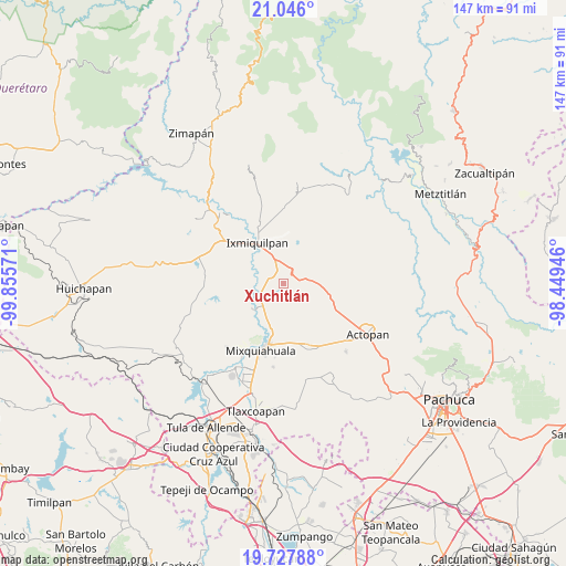
Xuchitlán GPS coordinates[2]
20° 23' 18.06" North, 99° 9' 9.288" West
| Map corner | latitude | longitude |
|---|---|---|
| Upper-left | 21.046°, | -99.85571° |
| Center: | 20.38835°, | -99.15258° |
| Lower-right: | 19.72788°, | -98.44946° |
| Map W x H: | 146.6×146.6 km | = 91.1×91.1mi |
| max Lat: | 32.7° ⇑34.6% North |
| Xuchitlán: | 20.38835° |
| min Lat: | ⇓65.4% South 14.53588° |
| min Long | Xuchitlán | max Long |
| -117.105° | -99.15258° | -86.73105° |
| W 48.1%⇐ | ⇒51.9% E |
Elevation
Elevation of Xuchitlán is 1936 m = 6352 ft, and this is 682.3 m = 2239 ft above average elevation for this country.
| Max E: |
3497 m = 11473 ft | 29.5% |
| Xuchitlán | 1936 m 6352 ft | |
| Avg. | 1253.7 m = 4113 ft | |
Min E: |
-1 m = -3 ft | 70.5% |
See also: Mexico elevation on elevation.city.
Geographical zone
Xuchitlán is located in North Torrid zone (between Equator and Tropic of Cancer). Distance of this Northern Tropic circle is 338.9 km =210.6 mi to North.| Distance of | km | miles | from Xuchitlán |
|---|---|---|---|
| North Pole | 7740.1 | 4809.5 | to North |
| Arctic Circle | 5134.2 | 3190.2 | to North |
| Tropic Cancer | 338.9 | 210.6 | to North |
| Equator | 2267 | 1408.6 | to South |


Nearby cities:
15 places around Xuchitlán: (largest is in red/bold)
• Bethí
7.7 km =4.8 mi,  276°
276°
• Cañada Chica
2.8 km =1.7 mi,  353°
353°
• El Barrido
8 km =5 mi,  329°
329°
• El Mejay
3.1 km =1.9 mi,  264°
264°
• El Tablón
5.1 km =3.2 mi,  313°
313°
• El Tephé
7.1 km =4.4 mi,  340°
340°
• El Xothi
2.7 km =1.7 mi, 309°
• Ex- Hacienda de Ocotza
7.3 km =4.5 mi,  54°
54°
• Julián Villagrán
5.1 km =3.2 mi,  79°
79°
• La Estancia
5.7 km =3.5 mi,  271°
271°
• Maguey Blanco
4.3 km =2.7 mi, 334°
• Pueblo Nuevo
7.6 km =4.7 mi, 348°
• Santa Ana Batha
4.2 km =2.6 mi, 256°
• Taxadho
5 km =3.1 mi,  3°
3°
• Tlactlapilco
7 km =4.3 mi, 258°
Sources, notices
• [Note1] Compared only with cities in Mexico existing in our database
• [Src1] Map data: © OpenStreetMap contributors (CC-BY-SA)
• [Src2] Other city data from geonames.org with taken over terms of usage.
• [Src3] Geographical zone / Annual Mean Temperature by Robert A. Rohde @ Wikipedia
