San José Palma Gorda geodata
San José Palma Gorda (Hidalgo) is a populated place; located in Mexico in America/Mexico_City (GMT-6) time zone. With population of 647 people, there are 13375 cities with bigger population in this country. Compared to other cities in Mexico, 57.4% of cities are located further ↓South; 54.4% of cities are located further ←West and 88% of cities have lower elevation than San José Palma Gorda. Note1
Current local time in San José Palma Gorda:
05:24 AM, WednesdayDifference from your time zone: hours


San José Palma Gorda GPS coordinates[2]
20° 1' 20.388" North, 98° 45' 3.636" West
| Map corner | latitude | longitude |
|---|---|---|
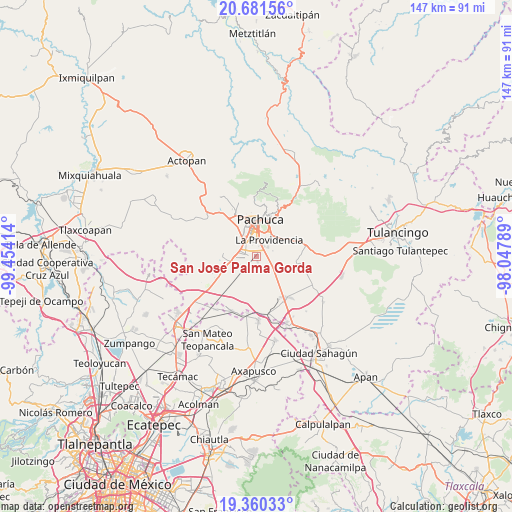
| Upper-left | 20.68156°, | -99.45414° |
| Center: | 20.02233°, | -98.75101° |
| Lower-right: | 19.36033°, | -98.04789° |
| Map W x H: | 146.9×146.9 km | = 91.3×91.3mi |
| max Lat: | 32.7° ⇑42.6% North |
| San José Palma Gorda: | 20.02233° |
| min Lat: | ⇓57.4% South 14.53588° |
| min Long | San José Palma | max Long |
| -117.105° | -98.75101° | -86.73105° |
| W 54.4%⇐ | ⇒45.6% E |
Elevation
Elevation of San José Palma Gorda is 2341 m = 7680 ft, and this is 1087.3 m = 3567 ft above average elevation for this country.
| Max E: |
3497 m = 11473 ft | 12% |
| San José Palma Gorda | 2341 m 7680 ft | |
| Avg. | 1253.7 m = 4113 ft | |
Min E: |
-1 m = -3 ft | 88% |
See also: Mexico elevation on elevation.city.
Geographical zone
San José Palma Gorda is located in North Torrid zone (between Equator and Tropic of Cancer). Distance of this Northern Tropic circle is 379.6 km =235.9 mi to North.| Distance of | km | miles | from San José Palma Gorda |
|---|---|---|---|
| North Pole | 7780.8 | 4834.8 | to North |
| Arctic Circle | 5174.9 | 3215.5 | to North |
| Tropic Cancer | 379.6 | 235.9 | to North |
| Equator | 2226.3 | 1383.4 | to South |


Nearby cities:
15 places around San José Palma Gorda: (largest is in red/bold)
• Bosques del Mineral
4.7 km =2.9 mi,  327°
327°
• Cipreses
4.4 km =2.7 mi,  337°
337°
• El Paraíso
4.5 km =2.8 mi,  12°
12°
• El Roble
4 km =2.5 mi,  349°
349°
• El Venado
4.6 km =2.9 mi, 348°
• Forjadores de Pachuca
3.9 km =2.4 mi, 340°
• La Colonia
4.1 km =2.5 mi, 330°
• Las Flores
3.3 km =2.1 mi, 337°
• Los Tuzos
3.6 km =2.2 mi, 350°
• Magisterio Digno
4.3 km =2.7 mi, 334°
• Rinconada de los Ángeles
4.2 km =2.6 mi,  84°
84°
• San Miguel Nopalapa
4.1 km =2.5 mi,  100°
100°
• Santa María la Calera
3.4 km =2.1 mi,  74°
74°
• Tulipanes
4.5 km =2.8 mi, 338°
• Villas de San Marcos
3.9 km =2.4 mi,  281°
281°
Sources, notices
• [Note1] Compared only with cities in Mexico existing in our database
• [Src1] Map data: © OpenStreetMap contributors (CC-BY-SA)
• [Src2] Other city data from geonames.org with taken over terms of usage.
• [Src3] Geographical zone / Annual Mean Temperature by Robert A. Rohde @ Wikipedia
