El Susto geodata
El Susto (Hidalgo) is a populated place; located in Mexico in America/Mexico_City (GMT-6) time zone. With population of 1,276 people, there are 6790 cities with bigger population in this country. Compared to other cities in Mexico, 58.3% of cities are located further ↓South; 57.3% of cities are located further ←West and 92.5% of cities have lower elevation than El Susto. Note1


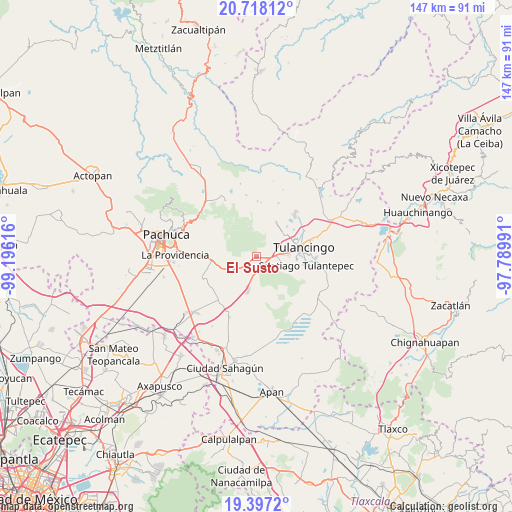
El Susto GPS coordinates[2]
20° 3' 32.58" North, 98° 29' 34.908" West
| Map corner | latitude | longitude |
|---|---|---|
| Upper-left | 20.71812°, | -99.19616° |
| Center: | 20.05905°, | -98.49303° |
| Lower-right: | 19.3972°, | -97.78991° |
| Map W x H: | 146.9×146.9 km | = 91.3×91.3mi |
| max Lat: | 32.7° ⇑41.7% North |
| El Susto: | 20.05905° |
| min Lat: | ⇓58.3% South 14.53588° |
| min Long | El Susto | max Long |
| -117.105° | -98.49303° | -86.73105° |
| W 57.3%⇐ | ⇒42.7% E |
Elevation
Elevation of El Susto is 2509 m = 8232 ft, and this is 1255.3 m = 4118 ft above average elevation for this country.
| Max E: |
3497 m = 11473 ft | 7.5% |
| El Susto | 2509 m 8232 ft | |
| Avg. | 1253.7 m = 4113 ft | |
Min E: |
-1 m = -3 ft | 92.5% |
See also: Mexico elevation on elevation.city.
Geographical zone
El Susto is located in North Torrid zone (between Equator and Tropic of Cancer). Distance of this Northern Tropic circle is 375.6 km =233.4 mi to North.| Distance of | km | miles | from El Susto |
|---|---|---|---|
| North Pole | 7776.7 | 4832.2 | to North |
| Arctic Circle | 5170.8 | 3213 | to North |
| Tropic Cancer | 375.6 | 233.4 | to North |
| Equator | 2230.4 | 1385.9 | to South |


Nearby cities:
15 places around El Susto: (largest is in red/bold)
• Ahuehuetitla
8.5 km =5.3 mi,  70°
70°
• Colonia Agustín Olvera
9.3 km =5.8 mi,  40°
40°
• Colonia Chauténco
9.1 km =5.7 mi,  30°
30°
• Colonia Felipe Ángeles
7.8 km =4.8 mi,  93°
93°
• Emiliano Zapata
9.2 km =5.7 mi,  76°
76°
• Fraccionamiento Carlos Salinas de Gortari
8.7 km =5.4 mi,  49°
49°
• Javier Rojo Gómez
7.9 km =4.9 mi, 81°
• La Lagunilla
1.9 km =1.2 mi,  57°
57°
• Los Romeros
8.8 km =5.5 mi,  111°
111°
• Mixquiapan
9.3 km =5.8 mi,  6°
6°
• Paxtepec
6.5 km =4 mi,  96°
96°
• Pedregal de San Francisco
9.4 km =5.8 mi, 85°
• Pedregal de San José
9 km =5.6 mi, 84°
• Segundas Lajas
2.4 km =1.5 mi, 114°
• Unidades Habitacionales
7.6 km =4.7 mi, 85°
Sources, notices
• [Note1] Compared only with cities in Mexico existing in our database
• [Src1] Map data: © OpenStreetMap contributors (CC-BY-SA)
• [Src2] Other city data from geonames.org with taken over terms of usage.
• [Src3] Geographical zone / Annual Mean Temperature by Robert A. Rohde @ Wikipedia
