Joaquín Miguel Gutiérrez geodata
Joaquín Miguel Gutiérrez (Chiapas) is a populated place; located in Mexico in America/Mexico_City (GMT-6) time zone. With population of 1,663 people, there are 5226 cities with bigger population in this country. Compared to other cities in Mexico, 95.2% of cities are located further ↑North; 86.9% of cities are located further ←West and 66% of cities have higher elevation than Joaquín Miguel Gutiérrez. Note1
Current local time in Joaquín Miguel Gutiérrez:
08:33 AM, WednesdayDifference from your time zone: hours


Joaquín Miguel Gutiérrez GPS coordinates[2]
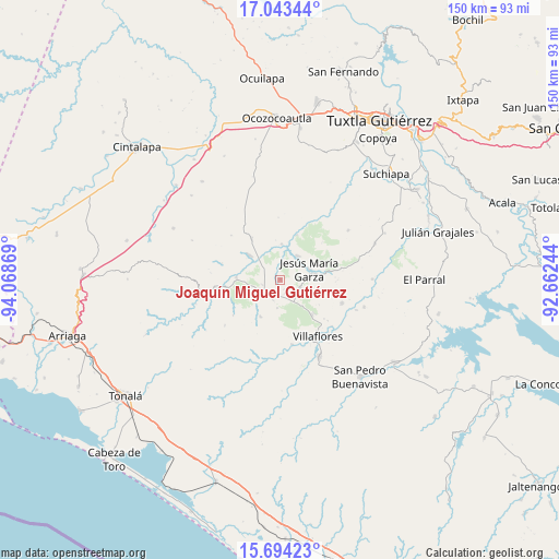
16° 22' 12" North, 93° 21' 56.016" West
| Map corner | latitude | longitude |
|---|---|---|
| Upper-left | 17.04344°, | -94.06869° |
| Center: | 16.37°, | -93.36556° |
| Lower-right: | 15.69423°, | -92.66244° |
| Map W x H: | 150×150 km | = 93.2×93.2mi |
| max Lat: | 32.7° ⇑95.2% North |
| Joaquín Miguel Gutiérrez: | 16.37° |
| min Lat: | ⇓4.8% South 14.53588° |
| min Long | Joaquín Miguel | max Long |
| -117.105° | -93.36556° | -86.73105° |
| W 86.9%⇐ | ⇒13.1% E |
Elevation
Elevation of Joaquín Miguel Gutiérrez is 636 m = 2087 ft, and this is 617.7 m = 2027 ft below average elevation for this country.
| Max E: |
3497 m = 11473 ft | 66% |
| Avg. | 1253.7 m = 4113 ft | |
| Joaquín Miguel Gutiérrez | 636 m = 2087 ft | |
Min E: |
-1 m = -3 ft | 34% |
See also: Mexico elevation on elevation.city.
Geographical zone
Joaquín Miguel Gutiérrez is located in North Torrid zone (between Equator and Tropic of Cancer). Distance of this Northern Tropic circle is 785.7 km =488.2 mi to North.| Distance of | km | miles | from Joaquín Miguel Gutiérrez |
|---|---|---|---|
| North Pole | 8186.9 | 5087.1 | to North |
| Arctic Circle | 5581 | 3467.9 | to North |
| Tropic Cancer | 785.7 | 488.2 | to North |
| Equator | 1820.2 | 1131 | to South |


Nearby cities:
15 places around Joaquín Miguel Gutiérrez: (largest is in red/bold)
• Agrónomos Mexicanos
17.7 km =11 mi,  262°
262°
• Benito Juárez
7.9 km =4.9 mi,  36°
36°
• Calzada Larga
5.8 km =3.6 mi,  111°
111°
• Cristóbal Obregón
12 km =7.5 mi,  305°
305°
• Cristóbal Obregón
18 km =11.2 mi, 262°
• Cuauhtémoc
17.7 km =11 mi, 110°
• Doctor Domingo Chanona
6.1 km =3.8 mi,  244°
244°
• El Portillo
14.9 km =9.3 mi,  49°
49°
• Francisco Villa
17.6 km =10.9 mi,  170°
170°
• Jesús María Garza
8.2 km =5.1 mi,  68°
68°
• Libertad Melchor Ocampo
11.7 km =7.3 mi,  272°
272°
• Nuevo México
13.5 km =8.4 mi,  325°
325°
• Tenochtitlán
9.6 km =6 mi,  2°
2°
• Unión y Progreso
12.9 km =8 mi,  20°
20°
• Úrsulo Galván
11.3 km =7 mi,  207°
207°
Sources, notices
• [Note1] Compared only with cities in Mexico existing in our database
• [Src1] Map data: © OpenStreetMap contributors (CC-BY-SA)
• [Src2] Other city data from geonames.org with taken over terms of usage.
• [Src3] Geographical zone / Annual Mean Temperature by Robert A. Rohde @ Wikipedia
