Unión y Progreso geodata
Unión y Progreso (Chiapas) is a populated place; located in Mexico in America/Mexico_City (GMT-6) time zone. With population of 791 people, there are 11037 cities with bigger population in this country. Compared to other cities in Mexico, 94.5% of cities are located further ↑North; 87.1% of cities are located further ←West and 66.9% of cities have higher elevation than Unión y Progreso. Note1


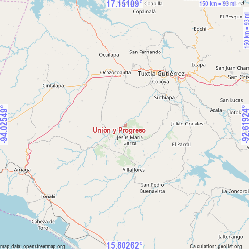
Unión y Progreso GPS coordinates[2]
16° 28' 40.908" North, 93° 19' 20.496" West
| Map corner | latitude | longitude |
|---|---|---|
| Upper-left | 17.15109°, | -94.02549° |
| Center: | 16.47803°, | -93.32236° |
| Lower-right: | 15.80262°, | -92.61924° |
| Map W x H: | 149.9×149.9 km | = 93.1×93.1mi |
| max Lat: | 32.7° ⇑94.5% North |
| Unión y Progreso: | 16.47803° |
| min Lat: | ⇓5.5% South 14.53588° |
| min Long | Unión y Progre | max Long |
| -117.105° | -93.32236° | -86.73105° |
| W 87.1%⇐ | ⇒12.9% E |
Elevation
Elevation of Unión y Progreso is 592 m = 1942 ft, and this is 661.7 m = 2171 ft below average elevation for this country.
| Max E: |
3497 m = 11473 ft | 66.9% |
| Avg. | 1253.7 m = 4113 ft | |
| Unión y Progreso | 592 m = 1942 ft | |
Min E: |
-1 m = -3 ft | 33.1% |
See also: Mexico elevation on elevation.city.
Geographical zone
Unión y Progreso is located in North Torrid zone (between Equator and Tropic of Cancer). Distance of this Northern Tropic circle is 773.7 km =480.8 mi to North.| Distance of | km | miles | from Unión y Progreso |
|---|---|---|---|
| North Pole | 8174.9 | 5079.6 | to North |
| Arctic Circle | 5569 | 3460.4 | to North |
| Tropic Cancer | 773.7 | 480.8 | to North |
| Equator | 1832.2 | 1138.5 | to South |


Nearby cities:
15 places around Unión y Progreso: (largest is in red/bold)
• Benito Juárez
5.6 km =3.5 mi,  179°
179°
• Calzada Larga
14.1 km =8.8 mi, 176°
• Cristóbal Obregón
15.2 km =9.4 mi,  250°
250°
• Cuauhtémoc
21.7 km =13.5 mi,  146°
146°
• Doctor Domingo Chanona
17.8 km =11.1 mi,  214°
214°
• El Portillo
7 km =4.3 mi,  108°
108°
• Guadalupe Victoria
16.6 km =10.3 mi,  355°
355°
• Hermenegildo Galeana
11.7 km =7.3 mi,  340°
340°
• Ignacio Zaragoza (El Morro)
13.8 km =8.6 mi,  347°
347°
• Jesús María Garza
9.5 km =5.9 mi,  161°
161°
• Joaquín Miguel Gutiérrez
12.9 km =8 mi,  200°
200°
• Libertad Melchor Ocampo
20 km =12.4 mi,  234°
234°
• Nuevo México
12.4 km =7.7 mi,  265°
265°
• Roblada Grande
13.6 km =8.5 mi,  84°
84°
• Tenochtitlán
4.9 km =3 mi,  239°
239°
Sources, notices
• [Note1] Compared only with cities in Mexico existing in our database
• [Src1] Map data: © OpenStreetMap contributors (CC-BY-SA)
• [Src2] Other city data from geonames.org with taken over terms of usage.
• [Src3] Geographical zone / Annual Mean Temperature by Robert A. Rohde @ Wikipedia
