Agua Amarga geodata
Agua Amarga (State of Mexico) is a populated place; located in Mexico in America/Mexico_City (GMT-6) time zone. With population of 621 people, there are 13905 cities with bigger population in this country. Compared to other cities in Mexico, 65.5% of cities are located further ↑North; 60.8% of cities are located further →East and 92.6% of cities have lower elevation than Agua Amarga. Note1


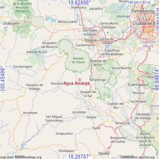
Agua Amarga GPS coordinates[2]
18° 57' 48.06" North, 99° 45' 6.696" West
| Map corner | latitude | longitude |
|---|---|---|
| Upper-left | 19.62698°, | -100.45499° |
| Center: | 18.96335°, | -99.75186° |
| Lower-right: | 18.29707°, | -99.04874° |
| Map W x H: | 147.9×147.9 km | = 91.9×91.9mi |
| max Lat: | 32.7° ⇑65.5% North |
| Agua Amarga: | 18.96335° |
| min Lat: | ⇓34.5% South 14.53588° |
| min Long | Agua Amarga | max Long |
| -117.105° | -99.75186° | -86.73105° |
| W 39.2%⇐ | ⇒60.8% E |
Elevation
Elevation of Agua Amarga is 2510 m = 8235 ft, and this is 1256.3 m = 4122 ft above average elevation for this country.
| Max E: |
3497 m = 11473 ft | 7.4% |
| Agua Amarga | 2510 m 8235 ft | |
| Avg. | 1253.7 m = 4113 ft | |
Min E: |
-1 m = -3 ft | 92.6% |
See also: Mexico elevation on elevation.city.
Geographical zone
Agua Amarga is located in North Torrid zone (between Equator and Tropic of Cancer). Distance of this Northern Tropic circle is 497.4 km =309.1 mi to North.| Distance of | km | miles | from Agua Amarga |
|---|---|---|---|
| North Pole | 7898.5 | 4907.9 | to North |
| Arctic Circle | 5292.6 | 3288.7 | to North |
| Tropic Cancer | 497.4 | 309.1 | to North |
| Equator | 2108.5 | 1310.2 | to South |


Nearby cities:
15 places around Agua Amarga: (largest is in red/bold)
• Cochisquila
5.5 km =3.4 mi,  179°
179°
• El Potrerito (El Potrero)
2.4 km =1.5 mi,  293°
293°
• Loma de Acuitlapilco
4.5 km =2.8 mi,  234°
234°
• Piedras Anchas (Primera del Monte)
3.7 km =2.3 mi,  299°
299°
• Porfirío Díaz
4.7 km =2.9 mi,  145°
145°
• Primera de Santa Ana
3.3 km =2.1 mi,  211°
211°
• San Fernando
0.8 km =0.5 mi, 294°
• San Gaspar
5.5 km =3.4 mi,  103°
103°
• San José del Progreso
5.3 km =3.3 mi, 232°
• Segunda de Analco (La Presa)
4.8 km =3 mi, 210°
• Segunda de Zacanguillo
3 km =1.9 mi,  238°
238°
• Tecolotepec
4.5 km =2.8 mi, 291°
• Teocotitla
6 km =3.7 mi,  320°
320°
• Zacango
5.7 km =3.5 mi, 98°
• Zacatones (San Felipe de Jesús)
3.5 km =2.2 mi,  274°
274°
Sources, notices
• [Note1] Compared only with cities in Mexico existing in our database
• [Src1] Map data: © OpenStreetMap contributors (CC-BY-SA)
• [Src2] Other city data from geonames.org with taken over terms of usage.
• [Src3] Geographical zone / Annual Mean Temperature by Robert A. Rohde @ Wikipedia
