Zacango geodata
Zacango (State of Mexico) is a populated place; located in Mexico in America/Mexico_City (GMT-6) time zone. With population of 3,586 people, there are 2551 cities with bigger population in this country. Compared to other cities in Mexico, 65.7% of cities are located further ↑North; 60.2% of cities are located further →East and 82.4% of cities have lower elevation than Zacango. Note1


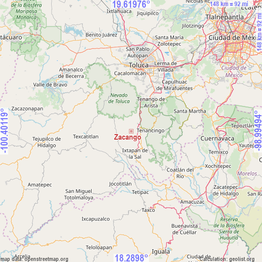
Zacango GPS coordinates[2]
18° 57' 21.996" North, 99° 41' 53.016" West
| Map corner | latitude | longitude |
|---|---|---|
| Upper-left | 19.61976°, | -100.40119° |
| Center: | 18.95611°, | -99.69806° |
| Lower-right: | 18.2898°, | -98.99494° |
| Map W x H: | 147.9×147.9 km | = 91.9×91.9mi |
| max Lat: | 32.7° ⇑65.7% North |
| Zacango: | 18.95611° |
| min Lat: | ⇓34.3% South 14.53588° |
| min Long | Zacango | max Long |
| -117.105° | -99.69806° | -86.73105° |
| W 39.8%⇐ | ⇒60.2% E |
Elevation
Elevation of Zacango is 2198 m = 7211 ft, and this is 944.3 m = 3098 ft above average elevation for this country.
| Max E: |
3497 m = 11473 ft | 17.6% |
| Zacango | 2198 m 7211 ft | |
| Avg. | 1253.7 m = 4113 ft | |
Min E: |
-1 m = -3 ft | 82.4% |
See also: Mexico elevation on elevation.city.
Geographical zone
Zacango is located in North Torrid zone (between Equator and Tropic of Cancer). Distance of this Northern Tropic circle is 498.2 km =309.6 mi to North.| Distance of | km | miles | from Zacango |
|---|---|---|---|
| North Pole | 7899.3 | 4908.4 | to North |
| Arctic Circle | 5293.5 | 3289.2 | to North |
| Tropic Cancer | 498.2 | 309.6 | to North |
| Equator | 2107.7 | 1309.7 | to South |


Nearby cities:
15 places around Zacango: (largest is in red/bold)
• Agua Amarga
5.7 km =3.5 mi,  278°
278°
• Buenavista
4.5 km =2.8 mi,  105°
105°
• Ejido de San Mateo Coapexco
5.9 km =3.7 mi,  97°
97°
• El Carmen
5.1 km =3.2 mi,  203°
203°
• El Islote
4.3 km =2.7 mi,  72°
72°
• La Joya
5.1 km =3.2 mi, 69°
• Porfirío Díaz
4.3 km =2.7 mi,  224°
224°
• San Felipe
5.3 km =3.3 mi,  119°
119°
• San Francisco
5.4 km =3.4 mi, 98°
• San Gaspar
0.6 km =0.4 mi, 217°
• San Lucas
4.6 km =2.9 mi,  58°
58°
• San Mateo Coapexco
1.7 km =1.1 mi, 68°
• San Miguel
5.2 km =3.2 mi,  41°
41°
• Santiago Oxtotitlán
3.2 km =2 mi,  79°
79°
• Totolmajac
3.5 km =2.2 mi,  158°
158°
Sources, notices
• [Note1] Compared only with cities in Mexico existing in our database
• [Src1] Map data: © OpenStreetMap contributors (CC-BY-SA)
• [Src2] Other city data from geonames.org with taken over terms of usage.
• [Src3] Geographical zone / Annual Mean Temperature by Robert A. Rohde @ Wikipedia
