La Purificación geodata
La Purificación (State of Mexico) is a populated place; located in Mexico in America/Mexico_City (GMT-6) time zone. With population of 3,790 people, there are 2412 cities with bigger population in this country. Compared to other cities in Mexico, 53.6% of cities are located further ↑North; 53.3% of cities are located further ←West and 89.1% of cities have lower elevation than La Purificación. Note1


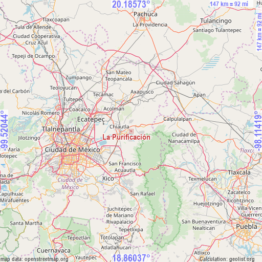
La Purificación GPS coordinates[2]
19° 31' 27.876" North, 98° 49' 2.316" West
| Map corner | latitude | longitude |
|---|---|---|
| Upper-left | 20.18573°, | -99.52044° |
| Center: | 19.52441°, | -98.81731° |
| Lower-right: | 18.86037°, | -98.11419° |
| Map W x H: | 147.4×147.4 km | = 91.6×91.6mi |
| max Lat: | 32.7° ⇑53.6% North |
| La Purificación: | 19.52441° |
| min Lat: | ⇓46.4% South 14.53588° |
| min Long | La Purificació | max Long |
| -117.105° | -98.81731° | -86.73105° |
| W 53.3%⇐ | ⇒46.7% E |
Elevation
Elevation of La Purificación is 2377 m = 7799 ft, and this is 1123.3 m = 3685 ft above average elevation for this country.
| Max E: |
3497 m = 11473 ft | 10.9% |
| La Purificación | 2377 m 7799 ft | |
| Avg. | 1253.7 m = 4113 ft | |
Min E: |
-1 m = -3 ft | 89.1% |
See also: Mexico elevation on elevation.city.
Geographical zone
La Purificación is located in North Torrid zone (between Equator and Tropic of Cancer). Distance of this Northern Tropic circle is 435 km =270.3 mi to North.| Distance of | km | miles | from La Purificación |
|---|---|---|---|
| North Pole | 7836.2 | 4869.2 | to North |
| Arctic Circle | 5230.3 | 3250 | to North |
| Tropic Cancer | 435 | 270.3 | to North |
| Equator | 2170.9 | 1348.9 | to South |


Nearby cities:
15 places around La Purificación: (largest is in red/bold)
• Colonia Santiago
3.8 km =2.4 mi,  342°
342°
• Colonia Tulteca Teopan
5 km =3.1 mi,  325°
325°
• Papalotla
6 km =3.7 mi,  316°
316°
• San Andrés de las Peras
4.4 km =2.7 mi,  36°
36°
• San Bernardo Tlalmimilolpan
4.9 km =3 mi,  31°
31°
• San Joaquín Coapango
2.1 km =1.3 mi, 329°
• San Miguel Tlaixpan
1.8 km =1.1 mi,  157°
157°
• San Pablo Ixayoc
6.1 km =3.8 mi, 157°
• San Pedro Chiautzingo
6 km =3.7 mi, 29°
• Santa María Tecuanulco
6.1 km =3.8 mi,  108°
108°
• Tepetlaoxtoc de Hidalgo
5.6 km =3.5 mi,  358°
358°
• Tequexquináhuac
5.3 km =3.3 mi,  188°
188°
• Tulantongo
6.1 km =3.8 mi,  277°
277°
• Xochimanca
3.8 km =2.4 mi, 191°
• Xocotlán
3.2 km =2 mi,  253°
253°
Sources, notices
• [Note1] Compared only with cities in Mexico existing in our database
• [Src1] Map data: © OpenStreetMap contributors (CC-BY-SA)
• [Src2] Other city data from geonames.org with taken over terms of usage.
• [Src3] Geographical zone / Annual Mean Temperature by Robert A. Rohde @ Wikipedia
