Papalotla geodata
Papalotla (State of Mexico) is a seat of a second-order administrative division; located in Mexico in America/Mexico_City (GMT-6) time zone. With population of 4,076 people, there are 2238 cities with bigger population in this country. Compared to other cities in Mexico, 52.8% of cities are located further ↑North; 52.7% of cities are located further ←West and 85.6% of cities have lower elevation than Papalotla. Note1


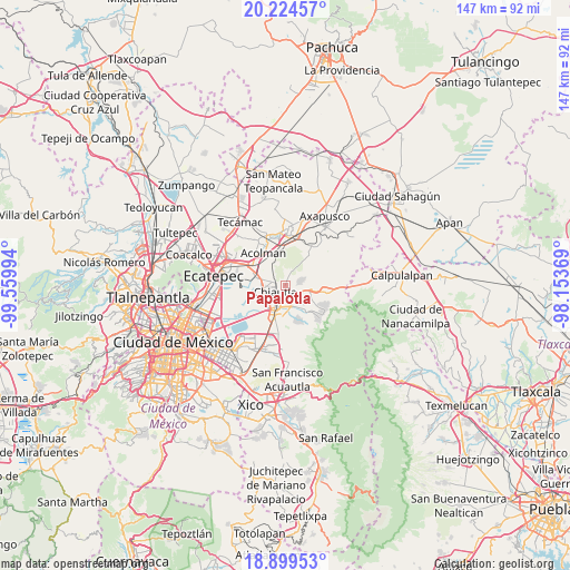
Papalotla GPS coordinates[2]
19° 33' 48.276" North, 98° 51' 24.516" West
| Map corner | latitude | longitude |
|---|---|---|
| Upper-left | 20.22457°, | -99.55994° |
| Center: | 19.56341°, | -98.85681° |
| Lower-right: | 18.89953°, | -98.15369° |
| Map W x H: | 147.3×147.3 km | = 91.5×91.5mi |
| max Lat: | 32.7° ⇑52.8% North |
| Papalotla: | 19.56341° |
| min Lat: | ⇓47.2% South 14.53588° |
| min Long | Papalotla | max Long |
| -117.105° | -98.85681° | -86.73105° |
| W 52.7%⇐ | ⇒47.3% E |
Elevation
Elevation of Papalotla is 2270 m = 7448 ft, and this is 1016.3 m = 3334 ft above average elevation for this country.
| Max E: |
3497 m = 11473 ft | 14.4% |
| Papalotla | 2270 m 7448 ft | |
| Avg. | 1253.7 m = 4113 ft | |
Min E: |
-1 m = -3 ft | 85.6% |
See also: Mexico elevation on elevation.city.
Geographical zone
Papalotla is located in North Torrid zone (between Equator and Tropic of Cancer). Distance of this Northern Tropic circle is 430.7 km =267.6 mi to North.| Distance of | km | miles | from Papalotla |
|---|---|---|---|
| North Pole | 7831.8 | 4866.5 | to North |
| Arctic Circle | 5225.9 | 3247.2 | to North |
| Tropic Cancer | 430.7 | 267.6 | to North |
| Equator | 2175.2 | 1351.6 | to South |


Nearby cities:
15 places around Papalotla: (largest is in red/bold)
• Atenguillo
2.1 km =1.3 mi,  270°
270°
• Chiautla
3.1 km =1.9 mi,  239°
239°
• Chiconcuac
4.4 km =2.7 mi,  264°
264°
• Colonia Santiago
3.1 km =1.9 mi,  103°
103°
• Colonia Tulteca Teopan
1.3 km =0.8 mi, 99°
• Colonia la Loma (La loma San Isidro)
4.2 km =2.6 mi,  46°
46°
• Concepción Jolalpan
2.5 km =1.6 mi,  25°
25°
• Ejido San Cristóbal
4.6 km =2.9 mi, 239°
• San Joaquín Coapango
4 km =2.5 mi,  129°
129°
• San Lucas Huitzilhuacán
3.8 km =2.4 mi,  312°
312°
• Santiago Chimalpa (Chimalpa)
3.7 km =2.3 mi,  279°
279°
• Tepetitlán
1.8 km =1.1 mi, 305°
• Tepetlaoxtoc de Hidalgo
4.2 km =2.6 mi,  73°
73°
• Tlaltecahuacán
3 km =1.9 mi,  304°
304°
• Tulantongo
4 km =2.5 mi,  207°
207°
Sources, notices
• [Note1] Compared only with cities in Mexico existing in our database
• [Src1] Map data: © OpenStreetMap contributors (CC-BY-SA)
• [Src2] Other city data from geonames.org with taken over terms of usage.
• [Src3] Geographical zone / Annual Mean Temperature by Robert A. Rohde @ Wikipedia
