San Lucas Tepango geodata
San Lucas Tepango (State of Mexico) is a populated place; located in Mexico in America/Mexico_City (GMT-6) time zone. With population of 811 people, there are 10778 cities with bigger population in this country. Compared to other cities in Mexico, 51% of cities are located further ↑North; 52.6% of cities are located further ←West and 87.3% of cities have lower elevation than San Lucas Tepango. Note1


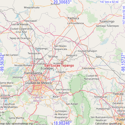
San Lucas Tepango GPS coordinates[2]
19° 38' 45.636" North, 98° 51' 37.764" West
| Map corner | latitude | longitude |
|---|---|---|
| Upper-left | 20.30683°, | -99.56362° |
| Center: | 19.64601°, | -98.86049° |
| Lower-right: | 18.98246°, | -98.15737° |
| Map W x H: | 147.3×147.3 km | = 91.5×91.5mi |
| max Lat: | 32.7° ⇑51% North |
| San Lucas Tepango: | 19.64601° |
| min Lat: | ⇓49% South 14.53588° |
| min Long | San Lucas Tepan | max Long |
| -117.105° | -98.86049° | -86.73105° |
| W 52.6%⇐ | ⇒47.4% E |
Elevation
Elevation of San Lucas Tepango is 2318 m = 7605 ft, and this is 1064.3 m = 3492 ft above average elevation for this country.
| Max E: |
3497 m = 11473 ft | 12.7% |
| San Lucas Tepango | 2318 m 7605 ft | |
| Avg. | 1253.7 m = 4113 ft | |
Min E: |
-1 m = -3 ft | 87.3% |
See also: Mexico elevation on elevation.city.
Geographical zone
San Lucas Tepango is located in North Torrid zone (between Equator and Tropic of Cancer). Distance of this Northern Tropic circle is 421.5 km =261.9 mi to North.| Distance of | km | miles | from San Lucas Tepango |
|---|---|---|---|
| North Pole | 7822.6 | 4860.7 | to North |
| Arctic Circle | 5216.7 | 3241.5 | to North |
| Tropic Cancer | 421.5 | 261.9 | to North |
| Equator | 2184.4 | 1357.3 | to South |


Nearby cities:
15 places around San Lucas Tepango: (largest is in red/bold)
• Acolman de Netzahualcóyotl
5 km =3.1 mi,  262°
262°
• Atlatongo
5.2 km =3.2 mi,  297°
297°
• Ejido Atlatongo
5.4 km =3.4 mi, 304°
• Ejido de San Sebastián
3.2 km =2 mi,  38°
38°
• El Potrero (Ejido Purificación)
3.5 km =2.2 mi,  337°
337°
• San Bartolo
4.5 km =2.8 mi,  283°
283°
• San Francisco Mazapa
5.7 km =3.5 mi,  28°
28°
• San José
5.4 km =3.4 mi,  286°
286°
• San Lorenzo Tlalmimilolpan
2.7 km =1.7 mi,  332°
332°
• San Pedro Tepetitlán
3.5 km =2.2 mi,  236°
236°
• San Sebastián Xolalpa
3.7 km =2.3 mi, 25°
• Santiago Tepetitlán
4.5 km =2.8 mi,  101°
101°
• Teotihuacán
4.7 km =2.9 mi,  359°
359°
• Teotihuacán de Arista
4.9 km =3 mi, 359°
• Xometla
2.3 km =1.4 mi, 260°
Sources, notices
• [Note1] Compared only with cities in Mexico existing in our database
• [Src1] Map data: © OpenStreetMap contributors (CC-BY-SA)
• [Src2] Other city data from geonames.org with taken over terms of usage.
• [Src3] Geographical zone / Annual Mean Temperature by Robert A. Rohde @ Wikipedia
