Acolman de Netzahualcóyotl geodata
Acolman de Netzahualcóyotl (State of Mexico) is a populated place; located in Mexico in America/Mexico_City (GMT-6) time zone. With population of 5,571 people, there are 1673 cities with bigger population in this country. Compared to other cities in Mexico, 51.1% of cities are located further ↑North; 51.8% of cities are located further ←West and 85% of cities have lower elevation than Acolman de Netzahualcóyotl. Note1
Current local time in Acolman de Netzahualcóyotl:
08:15 PM, TuesdayDifference from your time zone: hours


Acolman de Netzahualcóyotl GPS coordinates[2]
19° 38' 23.136" North, 98° 54' 27.972" West
| Map corner | latitude | longitude |
|---|---|---|
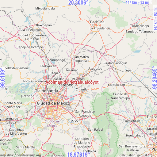
| Upper-left | 20.3006°, | -99.6109° |
| Center: | 19.63976°, | -98.90777° |
| Lower-right: | 18.97619°, | -98.20465° |
| Map W x H: | 147.3×147.3 km | = 91.5×91.5mi |
| max Lat: | 32.7° ⇑51.1% North |
| Acolman de Netzahualcóyotl: | 19.63976° |
| min Lat: | ⇓48.9% South 14.53588° |
| min Long | Acolman de Netz | max Long |
| -117.105° | -98.90777° | -86.73105° |
| W 51.8%⇐ | ⇒48.2% E |
Elevation
Elevation of Acolman de Netzahualcóyotl is 2259 m = 7411 ft, and this is 1005.3 m = 3298 ft above average elevation for this country.
| Max E: |
3497 m = 11473 ft | 15% |
| Acolman de Netzahualcóyotl | 2259 m 7411 ft | |
| Avg. | 1253.7 m = 4113 ft | |
Min E: |
-1 m = -3 ft | 85% |
See also: Mexico elevation on elevation.city.
Geographical zone
Acolman de Netzahualcóyotl is located in North Torrid zone (between Equator and Tropic of Cancer). Distance of this Northern Tropic circle is 422.2 km =262.3 mi to North.| Distance of | km | miles | from Acolman de Netzahualcóyotl |
|---|---|---|---|
| North Pole | 7823.3 | 4861.2 | to North |
| Arctic Circle | 5217.4 | 3241.9 | to North |
| Tropic Cancer | 422.2 | 262.3 | to North |
| Equator | 2183.7 | 1356.9 | to South |


Nearby cities:
15 places around Acolman de Netzahualcóyotl: (largest is in red/bold)
• Atlatongo
3.1 km =1.9 mi,  7°
7°
• Ejido Atlatongo
3.8 km =2.4 mi, 7°
• El Potrero (Ejido Purificación)
5.4 km =3.4 mi,  42°
42°
• La Concepción
4.3 km =2.7 mi,  169°
169°
• Ocopulco
5.7 km =3.5 mi, 168°
• San Bartolo
1.8 km =1.1 mi,  18°
18°
• San José
2.2 km =1.4 mi,  354°
354°
• San Lorenzo Tlalmimilolpan
4.8 km =3 mi,  50°
50°
• San Lucas Tepango
5 km =3.1 mi,  82°
82°
• San Marcos Nepantla
4.1 km =2.5 mi,  322°
322°
• San Pedro Tepetitlán
2.4 km =1.5 mi,  121°
121°
• Santa Catarina
2 km =1.2 mi,  259°
259°
• Tepexpan
4.2 km =2.6 mi,  226°
226°
• Tezoyuca
5.2 km =3.2 mi,  183°
183°
• Xometla
2.7 km =1.7 mi, 82°
Sources, notices
• [Note1] Compared only with cities in Mexico existing in our database
• [Src1] Map data: © OpenStreetMap contributors (CC-BY-SA)
• [Src2] Other city data from geonames.org with taken over terms of usage.
• [Src3] Geographical zone / Annual Mean Temperature by Robert A. Rohde @ Wikipedia
