El Cocoyult (Coacoyul) geodata
El Cocoyult (Coacoyul) (Guerrero) is a populated place; located in Mexico in America/Mexico_City (GMT-6) time zone. With population of 693 people, there are 12564 cities with bigger population in this country. Compared to other cities in Mexico, 92.2% of cities are located further ↑North; 56.9% of cities are located further →East and 81.9% of cities have higher elevation than El Cocoyult (Coacoyul). Note1


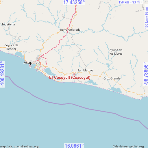
El Cocoyult (Coacoyul) GPS coordinates[2]
16° 45' 37.908" North, 99° 29' 22.848" West
| Map corner | latitude | longitude |
|---|---|---|
| Upper-left | 17.43258°, | -100.19281° |
| Center: | 16.76053°, | -99.48968° |
| Lower-right: | 16.0861°, | -98.78656° |
| Map W x H: | 149.7×149.7 km | = 93×93mi |
| max Lat: | 32.7° ⇑92.2% North |
| El Cocoyult (Coacoyul): | 16.76053° |
| min Lat: | ⇓7.8% South 14.53588° |
| min Long | El Cocoyult (Co | max Long |
| -117.105° | -99.48968° | -86.73105° |
| W 43.1%⇐ | ⇒56.9% E |
Elevation
Elevation of El Cocoyult (Coacoyul) is 71 m = 233 ft, and this is 1182.7 m = 3880 ft below average elevation for this country.
| Max E: |
3497 m = 11473 ft | 81.9% |
| Avg. | 1253.7 m = 4113 ft | |
| El Cocoyult (Coacoyul) | 71 m = 233 ft | |
Min E: |
-1 m = -3 ft | 18.1% |
See also: Mexico elevation on elevation.city.
Geographical zone
El Cocoyult (Coacoyul) is located in North Torrid zone (between Equator and Tropic of Cancer). Distance of this Northern Tropic circle is 742.3 km =461.2 mi to North.| Distance of | km | miles | from El Cocoyult (Coacoyul) |
|---|---|---|---|
| North Pole | 8143.5 | 5060.1 | to North |
| Arctic Circle | 5537.6 | 3440.9 | to North |
| Tropic Cancer | 742.3 | 461.2 | to North |
| Equator | 1863.6 | 1158 | to South |


Nearby cities:
15 places around El Cocoyult (Coacoyul): (largest is in red/bold)
• Apalani
14.8 km =9.2 mi,  314°
314°
• Barrio Nuevo de los Muertos
15.8 km =9.8 mi,  338°
338°
• Bella Vista Papagayo
11.9 km =7.4 mi,  277°
277°
• Campanario
12.1 km =7.5 mi, 313°
• Cerro de Piedra
15.1 km =9.4 mi, 276°
• El Cortés
2.6 km =1.6 mi,  329°
329°
• El Tamarindo
10.3 km =6.4 mi, 344°
• Las Minas
7.2 km =4.5 mi, 312°
• Llano de la Puerta
4.4 km =2.7 mi,  244°
244°
• Lomas de Chapultepec
13.7 km =8.5 mi,  248°
248°
• Monte Alto
5.5 km =3.4 mi,  150°
150°
• San Marcos
11.5 km =7.1 mi,  68°
68°
• Tasajeras
14.6 km =9.1 mi,  292°
292°
• Tecomate Nanchal
6.2 km =3.9 mi, 342°
• Tecomate Pesquería
15.1 km =9.4 mi,  118°
118°
Sources, notices
• [Note1] Compared only with cities in Mexico existing in our database
• [Src1] Map data: © OpenStreetMap contributors (CC-BY-SA)
• [Src2] Other city data from geonames.org with taken over terms of usage.
• [Src3] Geographical zone / Annual Mean Temperature by Robert A. Rohde @ Wikipedia
