Caxitepec geodata
Caxitepec (Guerrero) is a populated place; located in Mexico in America/Mexico_City (GMT-6) time zone. With population of 944 people, there are 9225 cities with bigger population in this country. Compared to other cities in Mexico, 87.6% of cities are located further ↑North; 51.2% of cities are located further ←West and 65.1% of cities have higher elevation than Caxitepec. Note1


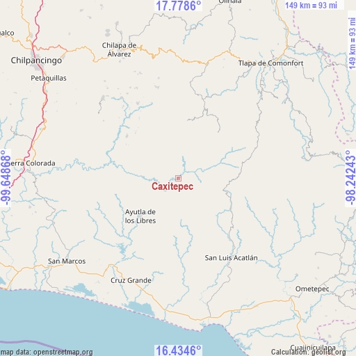
Caxitepec GPS coordinates[2]
17° 6' 28.116" North, 98° 56' 43.98" West
| Map corner | latitude | longitude |
|---|---|---|
| Upper-left | 17.7786°, | -99.64868° |
| Center: | 17.10781°, | -98.94555° |
| Lower-right: | 16.4346°, | -98.24243° |
| Map W x H: | 149.4×149.4 km | = 92.8×92.8mi |
| max Lat: | 32.7° ⇑87.6% North |
| Caxitepec: | 17.10781° |
| min Lat: | ⇓12.4% South 14.53588° |
| min Long | Caxitepec | max Long |
| -117.105° | -98.94555° | -86.73105° |
| W 51.2%⇐ | ⇒48.8% E |
Elevation
Elevation of Caxitepec is 680 m = 2231 ft, and this is 573.7 m = 1882 ft below average elevation for this country.
| Max E: |
3497 m = 11473 ft | 65.1% |
| Avg. | 1253.7 m = 4113 ft | |
| Caxitepec | 680 m = 2231 ft | |
Min E: |
-1 m = -3 ft | 34.9% |
See also: Mexico elevation on elevation.city.
Geographical zone
Caxitepec is located in North Torrid zone (between Equator and Tropic of Cancer). Distance of this Northern Tropic circle is 703.7 km =437.3 mi to North.| Distance of | km | miles | from Caxitepec |
|---|---|---|---|
| North Pole | 8104.9 | 5036.1 | to North |
| Arctic Circle | 5499 | 3416.9 | to North |
| Tropic Cancer | 703.7 | 437.3 | to North |
| Equator | 1902.2 | 1182 | to South |


Nearby cities:
15 places around Caxitepec: (largest is in red/bold)
• Agua Tordillo
14 km =8.7 mi,  341°
341°
• Barranca Pobre
17.2 km =10.7 mi,  23°
23°
• Camalote
6.4 km =4 mi,  219°
219°
• Ciénega del Sauce
8.4 km =5.2 mi,  181°
181°
• Cuixinipa
17.2 km =10.7 mi,  1°
1°
• El Mirador
15 km =9.3 mi,  29°
29°
• El Salto
13.6 km =8.5 mi,  234°
234°
• Llano Grande
8.9 km =5.5 mi,  47°
47°
• Mexcaltepec
6.4 km =4 mi,  96°
96°
• Pascala del Oro
15.6 km =9.7 mi,  112°
112°
• Tecruz
11.4 km =7.1 mi,  243°
243°
• Tierra Blanca
13.8 km =8.6 mi,  290°
290°
• Totomixtlahuaca
16.1 km =10 mi,  69°
69°
• Tres Cruces
10.3 km =6.4 mi,  168°
168°
• Yerba Santa
12.2 km =7.6 mi, 32°
Sources, notices
• [Note1] Compared only with cities in Mexico existing in our database
• [Src1] Map data: © OpenStreetMap contributors (CC-BY-SA)
• [Src2] Other city data from geonames.org with taken over terms of usage.
• [Src3] Geographical zone / Annual Mean Temperature by Robert A. Rohde @ Wikipedia
