Chilixtlahuaca geodata
Chilixtlahuaca (Guerrero) is a populated place; located in Mexico in America/Mexico_City (GMT-6) time zone. With population of 826 people, there are 10586 cities with bigger population in this country. Compared to other cities in Mexico, 88.6% of cities are located further ↑North; 57.1% of cities are located further ←West and 63.4% of cities have higher elevation than Chilixtlahuaca. Note1


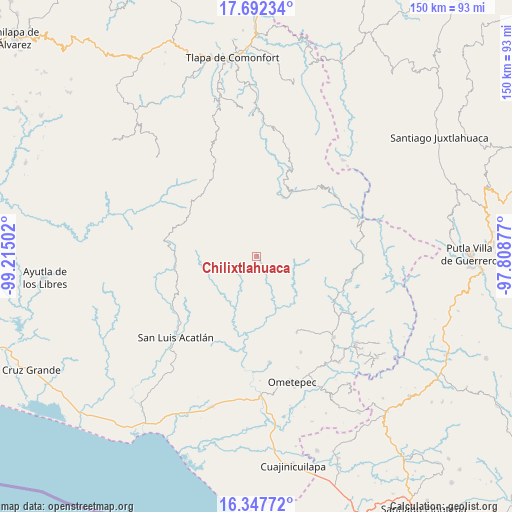
Chilixtlahuaca GPS coordinates[2]
17° 1' 16.464" North, 98° 30' 42.804" West
| Map corner | latitude | longitude |
|---|---|---|
| Upper-left | 17.69234°, | -99.21502° |
| Center: | 17.02124°, | -98.51189° |
| Lower-right: | 16.34772°, | -97.80877° |
| Map W x H: | 149.5×149.5 km | = 92.9×92.9mi |
| max Lat: | 32.7° ⇑88.6% North |
| Chilixtlahuaca: | 17.02124° |
| min Lat: | ⇓11.4% South 14.53588° |
| min Long | Chilixtlahuaca | max Long |
| -117.105° | -98.51189° | -86.73105° |
| W 57.1%⇐ | ⇒42.9% E |
Elevation
Elevation of Chilixtlahuaca is 791 m = 2595 ft, and this is 462.7 m = 1518 ft below average elevation for this country.
| Max E: |
3497 m = 11473 ft | 63.4% |
| Avg. | 1253.7 m = 4113 ft | |
| Chilixtlahuaca | 791 m = 2595 ft | |
Min E: |
-1 m = -3 ft | 36.6% |
See also: Mexico elevation on elevation.city.
Geographical zone
Chilixtlahuaca is located in North Torrid zone (between Equator and Tropic of Cancer). Distance of this Northern Tropic circle is 713.3 km =443.2 mi to North.| Distance of | km | miles | from Chilixtlahuaca |
|---|---|---|---|
| North Pole | 8114.5 | 5042.1 | to North |
| Arctic Circle | 5508.6 | 3422.9 | to North |
| Tropic Cancer | 713.3 | 443.2 | to North |
| Equator | 1892.6 | 1176 | to South |


Nearby cities:
15 places around Chilixtlahuaca: (largest is in red/bold)
• Aviación
18.6 km =11.6 mi,  280°
280°
• Buena Vista
9.8 km =6.1 mi,  228°
228°
• Chimalapa
11.3 km =7 mi,  152°
152°
• Cruztomáhuac
13.7 km =8.5 mi, 281°
• El Aserradero
16.7 km =10.4 mi,  264°
264°
• El Capulín
13.5 km =8.4 mi, 145°
• Iliatenco
18.7 km =11.6 mi, 278°
• Joya Real
15 km =9.3 mi,  62°
62°
• Llano Grande de Juárez
14.2 km =8.8 mi,  164°
164°
• Llano Silleta
14.1 km =8.8 mi, 229°
• Pueblo Hidalgo
17.1 km =10.6 mi,  243°
243°
• Río Iguapa
7.3 km =4.5 mi,  221°
221°
• San José Buenavista
18.9 km =11.7 mi,  174°
174°
• San José Vista Hermosa
18.4 km =11.4 mi, 259°
• Tuxtepec (Cofradía)
18.9 km =11.7 mi,  252°
252°
Sources, notices
• [Note1] Compared only with cities in Mexico existing in our database
• [Src1] Map data: © OpenStreetMap contributors (CC-BY-SA)
• [Src2] Other city data from geonames.org with taken over terms of usage.
• [Src3] Geographical zone / Annual Mean Temperature by Robert A. Rohde @ Wikipedia
