Naranjal Poniente geodata
Naranjal Poniente (Quintana Roo) is a populated place; located in Mexico in America/Cancun (GMT-5) time zone. With population of 754 people, there are 11619 cities with bigger population in this country. Compared to other cities in Mexico, 57.3% of cities are located further ↑North; 99.3% of cities are located further ←West and 91.2% of cities have higher elevation than Naranjal Poniente. Note1


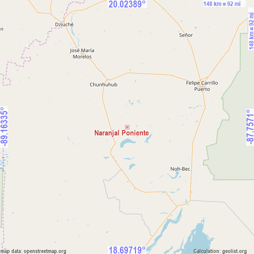
Naranjal Poniente GPS coordinates[2]
19° 21' 42.804" North, 88° 27' 36.792" West
| Map corner | latitude | longitude |
|---|---|---|
| Upper-left | 20.02389°, | -89.16335° |
| Center: | 19.36189°, | -88.46022° |
| Lower-right: | 18.69719°, | -87.7571° |
| Map W x H: | 147.5×147.5 km | = 91.7×91.7mi |
| max Lat: | 32.7° ⇑57.3% North |
| Naranjal Poniente: | 19.36189° |
| min Lat: | ⇓42.7% South 14.53588° |
| min Long | Naranjal Ponien | max Long |
| -117.105° | -88.46022° | -86.73105° |
| W 99.3%⇐ | ⇒0.7% E |
Elevation
Elevation of Naranjal Poniente is 21 m = 69 ft, and this is 1232.7 m = 4044 ft below average elevation for this country.
| Max E: |
3497 m = 11473 ft | 91.2% |
| Avg. | 1253.7 m = 4113 ft | |
| Naranjal Poniente | 21 m = 69 ft | |
Min E: |
-1 m = -3 ft | 8.8% |
See also: Mexico elevation on elevation.city.
Geographical zone
Naranjal Poniente is located in North Torrid zone (between Equator and Tropic of Cancer). Distance of this Northern Tropic circle is 453.1 km =281.5 mi to North.| Distance of | km | miles | from Naranjal Poniente |
|---|---|---|---|
| North Pole | 7854.2 | 4880.4 | to North |
| Arctic Circle | 5248.3 | 3261.1 | to North |
| Tropic Cancer | 453.1 | 281.5 | to North |
| Equator | 2152.8 | 1337.7 | to South |


Nearby cities:
15 places around Naranjal Poniente: (largest is in red/bold)
• Betania
35.6 km =22.1 mi,  30°
30°
• Chan Santa Cruz
13.5 km =8.4 mi,  87°
87°
• Chunhuhub
28.4 km =17.6 mi,  330°
330°
• Chunhuás
39.7 km =24.7 mi,  41°
41°
• Dzula
27.2 km =16.9 mi,  9°
9°
• Ignacio Manuel Altamirano
14.5 km =9 mi,  235°
235°
• La Pantera
24.8 km =15.4 mi,  187°
187°
• Laguna Kaná
17 km =10.6 mi,  22°
22°
• Los Divorciados
31.7 km =19.7 mi,  179°
179°
• Polyuc
29.4 km =18.3 mi,  338°
338°
• Presidente Juárez
11.3 km =7 mi,  250°
250°
• Santa María Poniente
5.6 km =3.5 mi,  83°
83°
• Vallehermoso
20.8 km =12.9 mi,  198°
198°
• X-pichil
38.1 km =23.7 mi, 13°
• X-yatil
33.4 km =20.8 mi,  2°
2°
Sources, notices
• [Note1] Compared only with cities in Mexico existing in our database
• [Src1] Map data: © OpenStreetMap contributors (CC-BY-SA)
• [Src2] Other city data from geonames.org with taken over terms of usage.
• [Src3] Geographical zone / Annual Mean Temperature by Robert A. Rohde @ Wikipedia
