Luis Echeverría Álvarez geodata
Luis Echeverría Álvarez (Quintana Roo) is a populated place; located in Mexico in America/Cancun (GMT-5) time zone. With population of 899 people, there are 9699 cities with bigger population in this country. Compared to other cities in Mexico, 70.7% of cities are located further ↑North; 99.6% of cities are located further ←West and 99.6% of cities have higher elevation than Luis Echeverría Álvarez. Note1
Current local time in Luis Echeverría Álvarez:
12:21 PM, MondayDifference from your time zone: hours


Luis Echeverría Álvarez GPS coordinates[2]
18° 39' 24.012" North, 88° 13' 5.988" West
| Map corner | latitude | longitude |
|---|---|---|
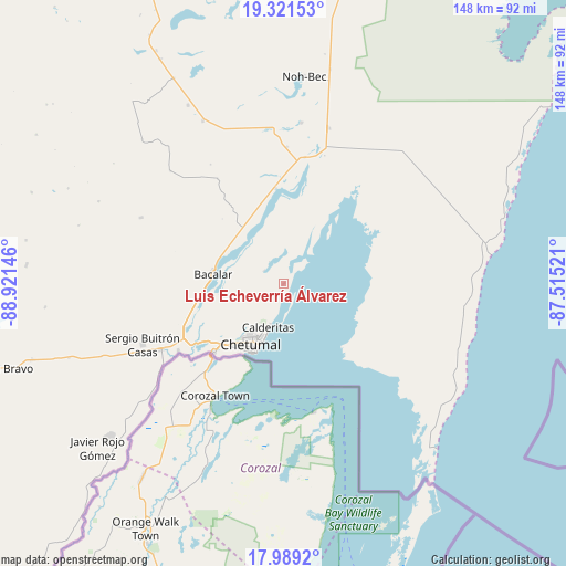
| Upper-left | 19.32153°, | -88.92146° |
| Center: | 18.65667°, | -88.21833° |
| Lower-right: | 17.9892°, | -87.51521° |
| Map W x H: | 148.1×148.1 km | = 92×92mi |
| max Lat: | 32.7° ⇑70.7% North |
| Luis Echeverría Álvarez: | 18.65667° |
| min Lat: | ⇓29.3% South 14.53588° |
| min Long | Luis Echeverrí | max Long |
| -117.105° | -88.21833° | -86.73105° |
| W 99.6%⇐ | ⇒0.40000000000001% E |
Elevation
Elevation of Luis Echeverría Álvarez is 4 m = 13 ft, and this is 1249.7 m = 4100 ft below average elevation for this country.
| Max E: |
3497 m = 11473 ft | 99.6% |
| Avg. | 1253.7 m = 4113 ft | |
| Luis Echeverría Álvarez | 4 m = 13 ft | |
Min E: |
-1 m = -3 ft | 0.4% |
See also: Mexico elevation on elevation.city.
Geographical zone
Luis Echeverría Álvarez is located in North Torrid zone (between Equator and Tropic of Cancer). Distance of this Northern Tropic circle is 531.5 km =330.3 mi to North.| Distance of | km | miles | from Luis Echeverría Álvarez |
|---|---|---|---|
| North Pole | 7932.6 | 4929.1 | to North |
| Arctic Circle | 5326.7 | 3309.9 | to North |
| Tropic Cancer | 531.5 | 330.3 | to North |
| Equator | 2074.4 | 1289 | to South |


Nearby cities:
15 places around Luis Echeverría Álvarez: (largest is in red/bold)
• Bacalar
18.6 km =11.6 mi,  278°
278°
• Calderitas
11.9 km =7.4 mi,  199°
199°
• Carlos A. Madrazo
36.6 km =22.7 mi,  241°
241°
• Chetumal
18.2 km =11.3 mi,  209°
209°
• Huay-Pix
26.9 km =16.7 mi,  234°
234°
• Juan Sarabia
32.6 km =20.3 mi, 237°
• Laguna Guerrero
6.3 km =3.9 mi,  305°
305°
• Maya Balam
36.8 km =22.9 mi,  328°
328°
• Miguel Hidalgo y Costilla
23.7 km =14.7 mi, 325°
• Sacxán
38.1 km =23.7 mi, 236°
• Salamanca
26.9 km =16.7 mi,  274°
274°
• San Isidro la Laguna
23.5 km =14.6 mi,  317°
317°
• Subteniente López
25.6 km =15.9 mi, 225°
• Ucum
36 km =22.4 mi, 241°
• Xul-Ha
28.4 km =17.6 mi,  245°
245°
Sources, notices
• [Note1] Compared only with cities in Mexico existing in our database
• [Src1] Map data: © OpenStreetMap contributors (CC-BY-SA)
• [Src2] Other city data from geonames.org with taken over terms of usage.
• [Src3] Geographical zone / Annual Mean Temperature by Robert A. Rohde @ Wikipedia
