Mazatepec geodata
Mazatepec (Veracruz) is a populated place; located in Mexico in America/Mexico_City (GMT-6) time zone. With population of 818 people, there are 10682 cities with bigger population in this country. Compared to other cities in Mexico, 52.5% of cities are located further ↑North; 74.6% of cities are located further ←West and 75.4% of cities have lower elevation than Mazatepec. Note1


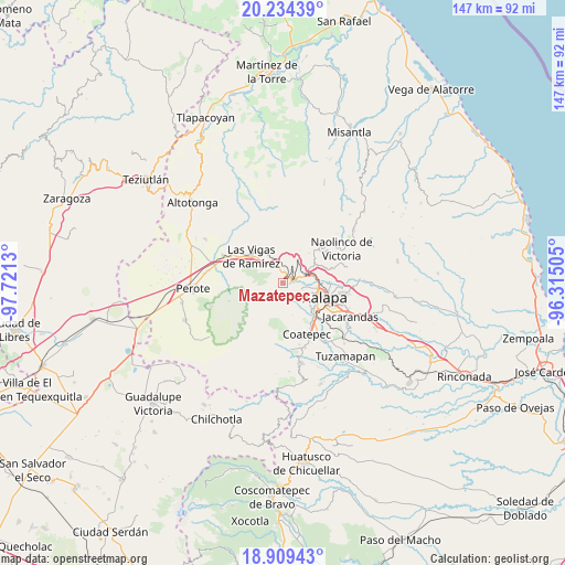
Mazatepec GPS coordinates[2]
19° 34' 23.772" North, 97° 1' 5.412" West
| Map corner | latitude | longitude |
|---|---|---|
| Upper-left | 20.23439°, | -97.7213° |
| Center: | 19.57327°, | -97.01817° |
| Lower-right: | 18.90943°, | -96.31505° |
| Map W x H: | 147.3×147.3 km | = 91.5×91.5mi |
| max Lat: | 32.7° ⇑52.5% North |
| Mazatepec: | 19.57327° |
| min Lat: | ⇓47.5% South 14.53588° |
| min Long | Mazatepec | max Long |
| -117.105° | -97.01817° | -86.73105° |
| W 74.6%⇐ | ⇒25.4% E |
Elevation
Elevation of Mazatepec is 2037 m = 6683 ft, and this is 783.3 m = 2570 ft above average elevation for this country.
| Max E: |
3497 m = 11473 ft | 24.6% |
| Mazatepec | 2037 m 6683 ft | |
| Avg. | 1253.7 m = 4113 ft | |
Min E: |
-1 m = -3 ft | 75.4% |
See also: Mexico elevation on elevation.city.
Geographical zone
Mazatepec is located in North Torrid zone (between Equator and Tropic of Cancer). Distance of this Northern Tropic circle is 429.6 km =266.9 mi to North.| Distance of | km | miles | from Mazatepec |
|---|---|---|---|
| North Pole | 7830.7 | 4865.8 | to North |
| Arctic Circle | 5224.8 | 3246.5 | to North |
| Tropic Cancer | 429.6 | 266.9 | to North |
| Equator | 2176.3 | 1352.3 | to South |


Nearby cities:
15 places around Mazatepec: (largest is in red/bold)
• Acajete
1.7 km =1.1 mi,  30°
30°
• Carolino Anaya (Espina Blanca)
5.7 km =3.5 mi,  109°
109°
• Cañada Larga
5.7 km =3.5 mi,  131°
131°
• El Rosario
5.5 km =3.4 mi,  70°
70°
• Guadalupe Victoria
6.4 km =4 mi, 108°
• Joya Chica
2.1 km =1.3 mi,  350°
350°
• La Joya
4.3 km =2.7 mi, 347°
• Naranjillos
5.3 km =3.3 mi,  124°
124°
• Otilpan
4.7 km =2.9 mi, 112°
• Piletas
4.5 km =2.8 mi, 68°
• Potrero del Bordo (Santa María)
6.1 km =3.8 mi, 130°
• Puentecillas
1.9 km =1.2 mi,  280°
280°
• Rafael Lucio
3.7 km =2.3 mi,  53°
53°
• San Antonio Hidalgo
6 km =3.7 mi, 126°
• Tlalnelhuayocan
4.5 km =2.8 mi,  99°
99°
Sources, notices
• [Note1] Compared only with cities in Mexico existing in our database
• [Src1] Map data: © OpenStreetMap contributors (CC-BY-SA)
• [Src2] Other city data from geonames.org with taken over terms of usage.
• [Src3] Geographical zone / Annual Mean Temperature by Robert A. Rohde @ Wikipedia
