Paso del Ingenio geodata
Paso del Ingenio (Veracruz) is a populated place; located in Mexico in America/Mexico_City (GMT-6) time zone. With population of 630 people, there are 13737 cities with bigger population in this country. Compared to other cities in Mexico, 71.4% of cities are located further ↑North; 83.4% of cities are located further ←West and 81.7% of cities have higher elevation than Paso del Ingenio. Note1


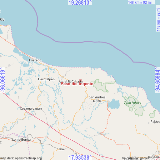
Paso del Ingenio GPS coordinates[2]
18° 36' 11.016" North, 95° 21' 47.016" West
| Map corner | latitude | longitude |
|---|---|---|
| Upper-left | 19.26813°, | -96.06619° |
| Center: | 18.60306°, | -95.36306° |
| Lower-right: | 17.93538°, | -94.65994° |
| Map W x H: | 148.2×148.2 km | = 92.1×92.1mi |
| max Lat: | 32.7° ⇑71.4% North |
| Paso del Ingenio: | 18.60306° |
| min Lat: | ⇓28.6% South 14.53588° |
| min Long | Paso del Ingeni | max Long |
| -117.105° | -95.36306° | -86.73105° |
| W 83.4%⇐ | ⇒16.6% E |
Elevation
Elevation of Paso del Ingenio is 73 m = 240 ft, and this is 1180.7 m = 3874 ft below average elevation for this country.
| Max E: |
3497 m = 11473 ft | 81.7% |
| Avg. | 1253.7 m = 4113 ft | |
| Paso del Ingenio | 73 m = 240 ft | |
Min E: |
-1 m = -3 ft | 18.3% |
See also: Mexico elevation on elevation.city.
Geographical zone
Paso del Ingenio is located in North Torrid zone (between Equator and Tropic of Cancer). Distance of this Northern Tropic circle is 537.5 km =334 mi to North.| Distance of | km | miles | from Paso del Ingenio |
|---|---|---|---|
| North Pole | 7938.6 | 4932.8 | to North |
| Arctic Circle | 5332.7 | 3313.6 | to North |
| Tropic Cancer | 537.5 | 334 | to North |
| Equator | 2068.5 | 1285.3 | to South |


Nearby cities:
15 places around Paso del Ingenio: (largest is in red/bold)
• Brazo de la Palma (El Rincón Caliente)
4.2 km =2.6 mi,  303°
303°
• Chonegal
4.5 km =2.8 mi,  226°
226°
• El Escobillal
7 km =4.3 mi,  248°
248°
• El Porvenir
7 km =4.3 mi,  9°
9°
• La Florida
2.8 km =1.7 mi,  340°
340°
• Laguna de Majahual
9.2 km =5.7 mi,  47°
47°
• Los Lirios
11.7 km =7.3 mi,  193°
193°
• Panatlán
6.2 km =3.9 mi,  359°
359°
• Popoctepetl
11.2 km =7 mi,  153°
153°
• Progreso del Majahual
9.7 km =6 mi,  25°
25°
• Sinapan
10.6 km =6.6 mi,  135°
135°
• Tapalapan
9.9 km =6.2 mi, 142°
• Tecolapan
4.4 km =2.7 mi, 145°
• Tula
2.3 km =1.4 mi,  218°
218°
• Ángel R. Cabada
8.8 km =5.5 mi,  264°
264°
Sources, notices
• [Note1] Compared only with cities in Mexico existing in our database
• [Src1] Map data: © OpenStreetMap contributors (CC-BY-SA)
• [Src2] Other city data from geonames.org with taken over terms of usage.
• [Src3] Geographical zone / Annual Mean Temperature by Robert A. Rohde @ Wikipedia
