Benito Juárez geodata
Benito Juárez (State of Mexico) is a populated place; located in Mexico in America/Mexico_City (GMT-6) time zone. With population of 2,342 people, there are 3768 cities with bigger population in this country. Compared to other cities in Mexico, 55.3% of cities are located further ↑North; 62.2% of cities are located further →East and 93.8% of cities have lower elevation than Benito Juárez. Note1


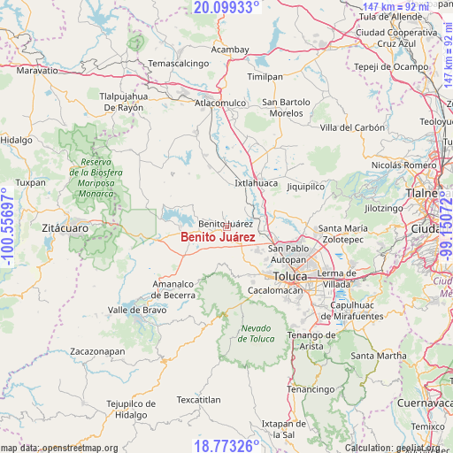
Benito Juárez GPS coordinates[2]
19° 26' 15.54" North, 99° 51' 13.824" West
| Map corner | latitude | longitude |
|---|---|---|
| Upper-left | 20.09933°, | -100.55697° |
| Center: | 19.43765°, | -99.85384° |
| Lower-right: | 18.77326°, | -99.15072° |
| Map W x H: | 147.4×147.4 km | = 91.6×91.6mi |
| max Lat: | 32.7° ⇑55.3% North |
| Benito Juárez: | 19.43765° |
| min Lat: | ⇓44.7% South 14.53588° |
| min Long | Benito Juárez | max Long |
| -117.105° | -99.85384° | -86.73105° |
| W 37.8%⇐ | ⇒62.2% E |
Elevation
Elevation of Benito Juárez is 2563 m = 8409 ft, and this is 1309.3 m = 4296 ft above average elevation for this country.
| Max E: |
3497 m = 11473 ft | 6.2% |
| Benito Juárez | 2563 m 8409 ft | |
| Avg. | 1253.7 m = 4113 ft | |
Min E: |
-1 m = -3 ft | 93.8% |
See also: Mexico elevation on elevation.city.
Geographical zone
Benito Juárez is located in North Torrid zone (between Equator and Tropic of Cancer). Distance of this Northern Tropic circle is 444.7 km =276.3 mi to North.| Distance of | km | miles | from Benito Juárez |
|---|---|---|---|
| North Pole | 7845.8 | 4875.2 | to North |
| Arctic Circle | 5239.9 | 3255.9 | to North |
| Tropic Cancer | 444.7 | 276.3 | to North |
| Equator | 2161.3 | 1343 | to South |


Nearby cities:
15 places around Benito Juárez: (largest is in red/bold)
• Barrio del Carmen
6.2 km =3.9 mi,  76°
76°
• Ejido San Diego
4 km =2.5 mi,  132°
132°
• Laguna de Tabernillas (El Resbaloso)
3.7 km =2.3 mi,  315°
315°
• Loma del Jacal (Loma de las Mangas)
4.2 km =2.6 mi,  328°
328°
• Loma del Salitre (Colonia Loma del Salitre)
2.4 km =1.5 mi,  40°
40°
• Mextepec
4.7 km =2.9 mi,  303°
303°
• Ocoyotepec (Ocoyotepec Centro)
6.5 km =4 mi,  10°
10°
• Paredón Ejido
6.5 km =4 mi,  164°
164°
• Salitrillo
0.6 km =0.4 mi,  140°
140°
• San Agustín Citlali
7.2 km =4.5 mi,  48°
48°
• San Agustín las Tablas
3.3 km =2.1 mi,  56°
56°
• San Joaquín del Monte
5.4 km =3.4 mi,  248°
248°
• San Pedro de la Hortaliza (Ejido Almoloyán)
6.7 km =4.2 mi,  145°
145°
• Santiaguito
4.4 km =2.7 mi, 147°
• Sitio Ejido
5.2 km =3.2 mi,  289°
289°
Sources, notices
• [Note1] Compared only with cities in Mexico existing in our database
• [Src1] Map data: © OpenStreetMap contributors (CC-BY-SA)
• [Src2] Other city data from geonames.org with taken over terms of usage.
• [Src3] Geographical zone / Annual Mean Temperature by Robert A. Rohde @ Wikipedia
