La Soledad geodata
La Soledad (State of Mexico) is a populated place; located in Mexico in America/Mexico_City (GMT-6) time zone. With population of 569 people, there are 15027 cities with bigger population in this country. Compared to other cities in Mexico, 55.5% of cities are located further ↓South; 62.7% of cities are located further →East and 94.2% of cities have lower elevation than La Soledad. Note1


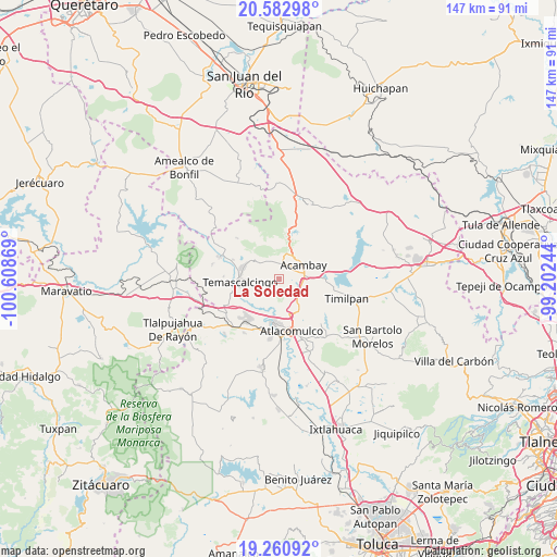
La Soledad GPS coordinates[2]
19° 55' 23.988" North, 99° 54' 20.016" West
| Map corner | latitude | longitude |
|---|---|---|
| Upper-left | 20.58298°, | -100.60869° |
| Center: | 19.92333°, | -99.90556° |
| Lower-right: | 19.26092°, | -99.20244° |
| Map W x H: | 147×147 km | = 91.3×91.3mi |
| max Lat: | 32.7° ⇑44.5% North |
| La Soledad: | 19.92333° |
| min Lat: | ⇓55.5% South 14.53588° |
| min Long | La Soledad | max Long |
| -117.105° | -99.90556° | -86.73105° |
| W 37.3%⇐ | ⇒62.7% E |
Elevation
Elevation of La Soledad is 2579 m = 8461 ft, and this is 1325.3 m = 4348 ft above average elevation for this country.
| Max E: |
3497 m = 11473 ft | 5.8% |
| La Soledad | 2579 m 8461 ft | |
| Avg. | 1253.7 m = 4113 ft | |
Min E: |
-1 m = -3 ft | 94.2% |
See also: Mexico elevation on elevation.city.
Geographical zone
La Soledad is located in North Torrid zone (between Equator and Tropic of Cancer). Distance of this Northern Tropic circle is 390.7 km =242.8 mi to North.| Distance of | km | miles | from La Soledad |
|---|---|---|---|
| North Pole | 7791.8 | 4841.6 | to North |
| Arctic Circle | 5185.9 | 3222.4 | to North |
| Tropic Cancer | 390.7 | 242.8 | to North |
| Equator | 2215.3 | 1376.5 | to South |


Nearby cities:
15 places around La Soledad: (largest is in red/bold)
• Bobashi de Guadalupe
5.3 km =3.3 mi,  186°
186°
• Boshindó
6.8 km =4.2 mi,  93°
93°
• Chosto de los Jarros
6.7 km =4.2 mi,  183°
183°
• Detiña (San Antonio Detiña)
5.7 km =3.5 mi,  23°
23°
• La Loma de San Mateo
1.7 km =1.1 mi,  197°
197°
• Pathé
6.9 km =4.3 mi, 86°
• Pueblo Nuevo
1.8 km =1.1 mi,  326°
326°
• San Bartolo Lanzados
6.4 km =4 mi,  169°
169°
• San Jerónimo de los Jarros
5.3 km =3.3 mi, 200°
• San Juan de los Jarros
6.9 km =4.3 mi, 189°
• San Mateo el Viejo
1.1 km =0.7 mi,  208°
208°
• San Pedro de los Metates
5.6 km =3.5 mi,  118°
118°
• San Pedro el Alto
6.2 km =3.9 mi,  256°
256°
• Santa Lucía (Ejido de San Mateo el Viejo)
3 km =1.9 mi, 183°
• Tixmadeje Chiquito
4.8 km =3 mi,  348°
348°
Sources, notices
• [Note1] Compared only with cities in Mexico existing in our database
• [Src1] Map data: © OpenStreetMap contributors (CC-BY-SA)
• [Src2] Other city data from geonames.org with taken over terms of usage.
• [Src3] Geographical zone / Annual Mean Temperature by Robert A. Rohde @ Wikipedia
