San Pedro el Alto geodata
San Pedro el Alto (State of Mexico) is a populated place; located in Mexico in America/Mexico_City (GMT-6) time zone. With population of 2,095 people, there are 4163 cities with bigger population in this country. Compared to other cities in Mexico, 55.3% of cities are located further ↓South; 63.5% of cities are located further →East and 98% of cities have lower elevation than San Pedro el Alto. Note1


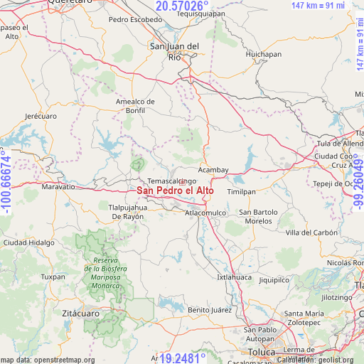
San Pedro el Alto GPS coordinates[2]
19° 54' 38.016" North, 99° 57' 48.996" West
| Map corner | latitude | longitude |
|---|---|---|
| Upper-left | 20.57026°, | -100.66674° |
| Center: | 19.91056°, | -99.96361° |
| Lower-right: | 19.2481°, | -99.26049° |
| Map W x H: | 147×147 km | = 91.3×91.3mi |
| max Lat: | 32.7° ⇑44.7% North |
| San Pedro el Alto: | 19.91056° |
| min Lat: | ⇓55.3% South 14.53588° |
| min Long | San Pedro el Al | max Long |
| -117.105° | -99.96361° | -86.73105° |
| W 36.5%⇐ | ⇒63.5% E |
Elevation
Elevation of San Pedro el Alto is 2742 m = 8996 ft, and this is 1488.3 m = 4883 ft above average elevation for this country.
| Max E: |
3497 m = 11473 ft | 2% |
| San Pedro el Alto | 2742 m 8996 ft | |
| Avg. | 1253.7 m = 4113 ft | |
Min E: |
-1 m = -3 ft | 98% |
See also: Mexico elevation on elevation.city.
Geographical zone
San Pedro el Alto is located in North Torrid zone (between Equator and Tropic of Cancer). Distance of this Northern Tropic circle is 392.1 km =243.6 mi to North.| Distance of | km | miles | from San Pedro el Alto |
|---|---|---|---|
| North Pole | 7793.2 | 4842.5 | to North |
| Arctic Circle | 5187.3 | 3223.2 | to North |
| Tropic Cancer | 392.1 | 243.6 | to North |
| Equator | 2213.8 | 1375.6 | to South |


Nearby cities:
15 places around San Pedro el Alto: (largest is in red/bold)
• Ahuacatitlan Centro
5.6 km =3.5 mi,  330°
330°
• Ahuacatitlán Cuarto y Quinto Cuartel
6.2 km =3.9 mi,  336°
336°
• Barrio de Corona
2.9 km =1.8 mi,  258°
258°
• Doxteje Barrio Primero
5.5 km =3.4 mi,  5°
5°
• La Loma de San Mateo
5.6 km =3.5 mi,  92°
92°
• La Magdalena
5.6 km =3.5 mi,  317°
317°
• La Soledad
6.2 km =3.9 mi,  76°
76°
• Los Pastores (Pastores Segundo Barrio)
6.3 km =3.9 mi,  197°
197°
• Pueblo Nuevo
5.9 km =3.7 mi,  59°
59°
• Puruahua
2.7 km =1.7 mi,  270°
270°
• San Jerónimo de los Jarros
5.5 km =3.4 mi,  130°
130°
• San José Toxi
5.5 km =3.4 mi,  149°
149°
• San Mateo el Viejo
5.5 km =3.4 mi, 85°
• Santa Lucía (Ejido de San Mateo el Viejo)
6.1 km =3.8 mi,  104°
104°
• Temascalcingo
4.2 km =2.6 mi,  278°
278°
Sources, notices
• [Note1] Compared only with cities in Mexico existing in our database
• [Src1] Map data: © OpenStreetMap contributors (CC-BY-SA)
• [Src2] Other city data from geonames.org with taken over terms of usage.
• [Src3] Geographical zone / Annual Mean Temperature by Robert A. Rohde @ Wikipedia
