San Antonio Nixini geodata
San Antonio Nixini (State of Mexico) is a populated place; located in Mexico in America/Mexico_City (GMT-6) time zone. With population of 1,182 people, there are 7354 cities with bigger population in this country. Compared to other cities in Mexico, 50.3% of cities are located further ↑North; 60% of cities are located further →East and 94.2% of cities have lower elevation than San Antonio Nixini. Note1


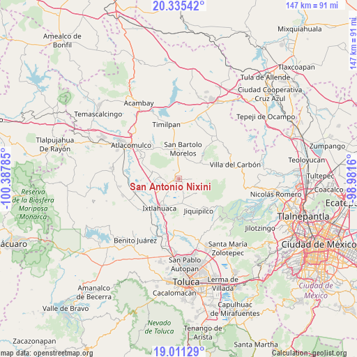
San Antonio Nixini GPS coordinates[2]
19° 40' 28.992" North, 99° 41' 4.992" West
| Map corner | latitude | longitude |
|---|---|---|
| Upper-left | 20.33542°, | -100.38785° |
| Center: | 19.67472°, | -99.68472° |
| Lower-right: | 19.01129°, | -98.9816° |
| Map W x H: | 147.2×147.2 km | = 91.5×91.5mi |
| max Lat: | 32.7° ⇑50.3% North |
| San Antonio Nixini: | 19.67472° |
| min Lat: | ⇓49.7% South 14.53588° |
| min Long | San Antonio Nix | max Long |
| -117.105° | -99.68472° | -86.73105° |
| W 40%⇐ | ⇒60% E |
Elevation
Elevation of San Antonio Nixini is 2579 m = 8461 ft, and this is 1325.3 m = 4348 ft above average elevation for this country.
| Max E: |
3497 m = 11473 ft | 5.8% |
| San Antonio Nixini | 2579 m 8461 ft | |
| Avg. | 1253.7 m = 4113 ft | |
Min E: |
-1 m = -3 ft | 94.2% |
See also: Mexico elevation on elevation.city.
Geographical zone
San Antonio Nixini is located in North Torrid zone (between Equator and Tropic of Cancer). Distance of this Northern Tropic circle is 418.3 km =259.9 mi to North.| Distance of | km | miles | from San Antonio Nixini |
|---|---|---|---|
| North Pole | 7819.4 | 4858.7 | to North |
| Arctic Circle | 5213.6 | 3239.6 | to North |
| Tropic Cancer | 418.3 | 259.9 | to North |
| Equator | 2187.6 | 1359.3 | to South |


Nearby cities:
15 places around San Antonio Nixini: (largest is in red/bold)
• Barrio de Boyecha
3.7 km =2.3 mi,  0°
0°
• Barrio de la Luz
5.4 km =3.4 mi,  324°
324°
• Barrio el Lindero
6.6 km =4.1 mi,  336°
336°
• Buenos Aires
6.6 km =4.1 mi,  164°
164°
• Colonia Emiliano Zapata
3.3 km =2.1 mi,  68°
68°
• Dolores Amarillas
5.8 km =3.6 mi,  204°
204°
• Ejido Loma de Malacota
2.4 km =1.5 mi,  143°
143°
• Meje
2.6 km =1.6 mi,  325°
325°
• Rancho Alegre
5.5 km =3.4 mi,  178°
178°
• San José Boqui
5.5 km =3.4 mi,  303°
303°
• San José la Epifania
6.5 km =4 mi,  43°
43°
• Santa María del Llano
6.2 km =3.9 mi,  223°
223°
• Santiago Yeché
4.7 km =2.9 mi, 322°
• Tiacaque
3 km =1.9 mi,  266°
266°
• Tlalpujahuilla
5.9 km =3.7 mi,  112°
112°
Sources, notices
• [Note1] Compared only with cities in Mexico existing in our database
• [Src1] Map data: © OpenStreetMap contributors (CC-BY-SA)
• [Src2] Other city data from geonames.org with taken over terms of usage.
• [Src3] Geographical zone / Annual Mean Temperature by Robert A. Rohde @ Wikipedia
