Dolores Amarillas geodata
Dolores Amarillas (State of Mexico) is a populated place; located in Mexico in America/Mexico_City (GMT-6) time zone. With population of 836 people, there are 10465 cities with bigger population in this country. Compared to other cities in Mexico, 51.4% of cities are located further ↑North; 60.3% of cities are located further →East and 93.3% of cities have lower elevation than Dolores Amarillas. Note1


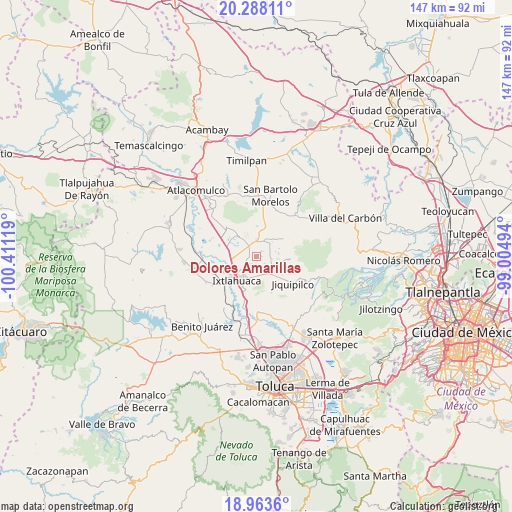
Dolores Amarillas GPS coordinates[2]
19° 37' 37.992" North, 99° 42' 29.016" West
| Map corner | latitude | longitude |
|---|---|---|
| Upper-left | 20.28811°, | -100.41119° |
| Center: | 19.62722°, | -99.70806° |
| Lower-right: | 18.9636°, | -99.00494° |
| Map W x H: | 147.3×147.3 km | = 91.5×91.5mi |
| max Lat: | 32.7° ⇑51.4% North |
| Dolores Amarillas: | 19.62722° |
| min Lat: | ⇓48.6% South 14.53588° |
| min Long | Dolores Amarill | max Long |
| -117.105° | -99.70806° | -86.73105° |
| W 39.7%⇐ | ⇒60.3% E |
Elevation
Elevation of Dolores Amarillas is 2546 m = 8353 ft, and this is 1292.3 m = 4240 ft above average elevation for this country.
| Max E: |
3497 m = 11473 ft | 6.7% |
| Dolores Amarillas | 2546 m 8353 ft | |
| Avg. | 1253.7 m = 4113 ft | |
Min E: |
-1 m = -3 ft | 93.3% |
See also: Mexico elevation on elevation.city.
Geographical zone
Dolores Amarillas is located in North Torrid zone (between Equator and Tropic of Cancer). Distance of this Northern Tropic circle is 423.6 km =263.2 mi to North.| Distance of | km | miles | from Dolores Amarillas |
|---|---|---|---|
| North Pole | 7824.7 | 4862 | to North |
| Arctic Circle | 5218.8 | 3242.8 | to North |
| Tropic Cancer | 423.6 | 263.2 | to North |
| Equator | 2182.3 | 1356 | to South |


Nearby cities:
15 places around Dolores Amarillas: (largest is in red/bold)
• Barrio de Trojes
5.1 km =3.2 mi,  277°
277°
• Buenos Aires
4.3 km =2.7 mi,  104°
104°
• Colonia la Purísima
6.5 km =4 mi,  148°
148°
• Ejido Loma de Malacota
5.1 km =3.2 mi,  48°
48°
• Loma de San Felipe
6.2 km =3.9 mi,  135°
135°
• Loma del Astillero
5.9 km =3.7 mi, 141°
• Manzana Tercera Loma de Hidalgo
6.9 km =4.3 mi,  126°
126°
• Manzana Tercera de Santa Cruz Tepexpan
6.5 km =4 mi,  175°
175°
• Rancho Alegre
2.6 km =1.6 mi,  94°
94°
• San Antonio Nixini
5.8 km =3.6 mi,  24°
24°
• San Bartolo del Llano
5.3 km =3.3 mi,  220°
220°
• San José del Sitio
5.2 km =3.2 mi,  121°
121°
• Santa María del Llano
1.9 km =1.2 mi,  294°
294°
• Tiacaque
5.1 km =3.2 mi,  353°
353°
• Tierra Blanca
6.7 km =4.2 mi,  155°
155°
Sources, notices
• [Note1] Compared only with cities in Mexico existing in our database
• [Src1] Map data: © OpenStreetMap contributors (CC-BY-SA)
• [Src2] Other city data from geonames.org with taken over terms of usage.
• [Src3] Geographical zone / Annual Mean Temperature by Robert A. Rohde @ Wikipedia
