Ejido de Dolores geodata
Ejido de Dolores (State of Mexico) is a populated place; located in Mexico in America/Mexico_City (GMT-6) time zone. With population of 2,419 people, there are 3645 cities with bigger population in this country. Compared to other cities in Mexico, 55.5% of cities are located further ↑North; 58.8% of cities are located further →East and 94.8% of cities have lower elevation than Ejido de Dolores. Note1


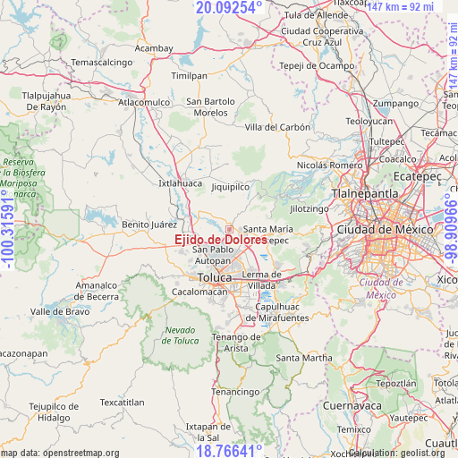
Ejido de Dolores GPS coordinates[2]
19° 25' 50.988" North, 99° 36' 46.008" West
| Map corner | latitude | longitude |
|---|---|---|
| Upper-left | 20.09254°, | -100.31591° |
| Center: | 19.43083°, | -99.61278° |
| Lower-right: | 18.76641°, | -98.90966° |
| Map W x H: | 147.5×147.5 km | = 91.7×91.7mi |
| max Lat: | 32.7° ⇑55.5% North |
| Ejido de Dolores: | 19.43083° |
| min Lat: | ⇓44.5% South 14.53588° |
| min Long | Ejido de Dolore | max Long |
| -117.105° | -99.61278° | -86.73105° |
| W 41.2%⇐ | ⇒58.8% E |
Elevation
Elevation of Ejido de Dolores is 2591 m = 8501 ft, and this is 1337.3 m = 4387 ft above average elevation for this country.
| Max E: |
3497 m = 11473 ft | 5.2% |
| Ejido de Dolores | 2591 m 8501 ft | |
| Avg. | 1253.7 m = 4113 ft | |
Min E: |
-1 m = -3 ft | 94.8% |
See also: Mexico elevation on elevation.city.
Geographical zone
Ejido de Dolores is located in North Torrid zone (between Equator and Tropic of Cancer). Distance of this Northern Tropic circle is 445.4 km =276.8 mi to North.| Distance of | km | miles | from Ejido de Dolores |
|---|---|---|---|
| North Pole | 7846.6 | 4875.6 | to North |
| Arctic Circle | 5240.7 | 3256.4 | to North |
| Tropic Cancer | 445.4 | 276.8 | to North |
| Equator | 2160.5 | 1342.5 | to South |


Nearby cities:
15 places around Ejido de Dolores: (largest is in red/bold)
• La Loma de Puente San Pedro
3.5 km =2.2 mi,  120°
120°
• La Magdalena Tenexpan
4.4 km =2.7 mi,  35°
35°
• La Y
4.4 km =2.7 mi,  146°
146°
• Llano de la Y
3.1 km =1.9 mi,  186°
186°
• Loma de Progreso
1.5 km =0.9 mi,  252°
252°
• Loma de San Nicolás
1.3 km =0.8 mi,  34°
34°
• Molino Abajo
2.4 km =1.5 mi, 27°
• San Antonio del Puente
1.5 km =0.9 mi,  198°
198°
• San Diego Alcalá
2.4 km =1.5 mi,  338°
338°
• San José Buenavista el Grande
4.1 km =2.5 mi,  127°
127°
• San José Pathé
2 km =1.2 mi,  284°
284°
• San José la Costa
3.2 km =2 mi,  271°
271°
• San Lorenzo Oyamel
3.7 km =2.3 mi,  85°
85°
• Silverio Galicia García
2.1 km =1.3 mi,  333°
333°
• Temoaya
4.5 km =2.8 mi, 25°
Sources, notices
• [Note1] Compared only with cities in Mexico existing in our database
• [Src1] Map data: © OpenStreetMap contributors (CC-BY-SA)
• [Src2] Other city data from geonames.org with taken over terms of usage.
• [Src3] Geographical zone / Annual Mean Temperature by Robert A. Rohde @ Wikipedia
