Loma de San Nicolás geodata
Loma de San Nicolás (State of Mexico) is a populated place; located in Mexico in America/Mexico_City (GMT-6) time zone. With population of 841 people, there are 10405 cities with bigger population in this country. Compared to other cities in Mexico, 55.3% of cities are located further ↑North; 58.7% of cities are located further →East and 95.5% of cities have lower elevation than Loma de San Nicolás. Note1


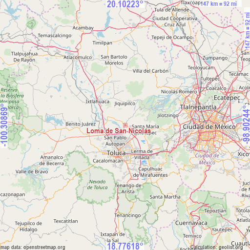
Loma de San Nicolás GPS coordinates[2]
19° 26' 26.016" North, 99° 36' 20.016" West
| Map corner | latitude | longitude |
|---|---|---|
| Upper-left | 20.10223°, | -100.30869° |
| Center: | 19.44056°, | -99.60556° |
| Lower-right: | 18.77618°, | -98.90244° |
| Map W x H: | 147.4×147.4 km | = 91.6×91.6mi |
| max Lat: | 32.7° ⇑55.3% North |
| Loma de San Nicolás: | 19.44056° |
| min Lat: | ⇓44.7% South 14.53588° |
| min Long | Loma de San Nic | max Long |
| -117.105° | -99.60556° | -86.73105° |
| W 41.3%⇐ | ⇒58.7% E |
Elevation
Elevation of Loma de San Nicolás is 2608 m = 8556 ft, and this is 1354.3 m = 4443 ft above average elevation for this country.
| Max E: |
3497 m = 11473 ft | 4.5% |
| Loma de San Nicolás | 2608 m 8556 ft | |
| Avg. | 1253.7 m = 4113 ft | |
Min E: |
-1 m = -3 ft | 95.5% |
See also: Mexico elevation on elevation.city.
Geographical zone
Loma de San Nicolás is located in North Torrid zone (between Equator and Tropic of Cancer). Distance of this Northern Tropic circle is 444.3 km =276.1 mi to North.| Distance of | km | miles | from Loma de San Nicolás |
|---|---|---|---|
| North Pole | 7845.5 | 4875 | to North |
| Arctic Circle | 5239.6 | 3255.7 | to North |
| Tropic Cancer | 444.3 | 276.1 | to North |
| Equator | 2161.6 | 1343.2 | to South |


Nearby cities:
15 places around Loma de San Nicolás: (largest is in red/bold)
• Ejido de Dolores
1.3 km =0.8 mi,  214°
214°
• La Loma de Puente San Pedro
3.7 km =2.3 mi,  141°
141°
• La Magdalena Tenexpan
3.1 km =1.9 mi,  35°
35°
• Loma de Progreso
2.6 km =1.6 mi,  234°
234°
• Molino Abajo
1.1 km =0.7 mi,  18°
18°
• Pothé
3.7 km =2.3 mi,  4°
4°
• San Antonio del Puente
2.8 km =1.7 mi, 206°
• San Diego Alcalá
2 km =1.2 mi,  305°
305°
• San José Comalco
4 km =2.5 mi,  327°
327°
• San José Pathé
2.7 km =1.7 mi,  257°
257°
• San José la Costa
4.1 km =2.5 mi, 255°
• San Lorenzo Oyamel
3 km =1.9 mi,  104°
104°
• Silverio Galicia García
1.9 km =1.2 mi,  296°
296°
• Temoaya
3.2 km =2 mi, 21°
• Tlaltenango Arriba
3.7 km =2.3 mi, 16°
Sources, notices
• [Note1] Compared only with cities in Mexico existing in our database
• [Src1] Map data: © OpenStreetMap contributors (CC-BY-SA)
• [Src2] Other city data from geonames.org with taken over terms of usage.
• [Src3] Geographical zone / Annual Mean Temperature by Robert A. Rohde @ Wikipedia
