San Pedro Zictepec geodata
San Pedro Zictepec (Morelos) is a populated place; located in Mexico in America/Mexico_City (GMT-6) time zone. With population of 5,571 people, there are 1673 cities with bigger population in this country. Compared to other cities in Mexico, 64.1% of cities are located further ↑North; 58.1% of cities are located further →East and 94% of cities have lower elevation than San Pedro Zictepec. Note1


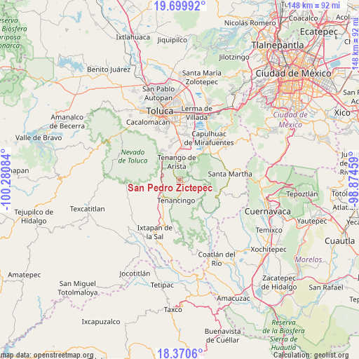
San Pedro Zictepec GPS coordinates[2]
19° 2' 11.724" North, 99° 34' 39.756" West
| Map corner | latitude | longitude |
|---|---|---|
| Upper-left | 19.69992°, | -100.28084° |
| Center: | 19.03659°, | -99.57771° |
| Lower-right: | 18.3706°, | -98.87459° |
| Map W x H: | 147.8×147.8 km | = 91.8×91.8mi |
| max Lat: | 32.7° ⇑64.1% North |
| San Pedro Zictepec: | 19.03659° |
| min Lat: | ⇓35.9% South 14.53588° |
| min Long | San Pedro Zicte | max Long |
| -117.105° | -99.57771° | -86.73105° |
| W 41.9%⇐ | ⇒58.1% E |
Elevation
Elevation of San Pedro Zictepec is 2572 m = 8438 ft, and this is 1318.3 m = 4325 ft above average elevation for this country.
| Max E: |
3497 m = 11473 ft | 6% |
| San Pedro Zictepec | 2572 m 8438 ft | |
| Avg. | 1253.7 m = 4113 ft | |
Min E: |
-1 m = -3 ft | 94% |
See also: Mexico elevation on elevation.city.
Geographical zone
San Pedro Zictepec is located in North Torrid zone (between Equator and Tropic of Cancer). Distance of this Northern Tropic circle is 489.2 km =304 mi to North.| Distance of | km | miles | from San Pedro Zictepec |
|---|---|---|---|
| North Pole | 7890.4 | 4902.9 | to North |
| Arctic Circle | 5284.5 | 3283.6 | to North |
| Tropic Cancer | 489.2 | 304 | to North |
| Equator | 2116.7 | 1315.3 | to South |


Nearby cities:
15 places around San Pedro Zictepec: (largest is in red/bold)
• Chalchihuapan
6.6 km =4.1 mi,  177°
177°
• Joquicingo
4.9 km =3 mi,  71°
71°
• La Compuerta
7 km =4.3 mi,  199°
199°
• La Herradura
0.8 km =0.5 mi,  297°
297°
• La Mesita
6 km =3.7 mi, 183°
• Las Cruces
7 km =4.3 mi,  335°
335°
• Maxtleca de Galeana
2.3 km =1.4 mi,  111°
111°
• Rinconada de Atotonilco
6.9 km =4.3 mi,  194°
194°
• San Antonio Agua Bendita
6.2 km =3.9 mi,  231°
231°
• San Bartolomé Atlatlahuca
5 km =3.1 mi,  317°
317°
• San Francisco Tepexoxica
4.1 km =2.5 mi,  49°
49°
• San Gabriel Zepayautla
3.8 km =2.4 mi,  134°
134°
• San Juan Xochiaca
4.8 km =3 mi,  122°
122°
• San Martín Coapaxtongo
4.8 km =3 mi,  170°
170°
• San Simonito
6.4 km =4 mi,  141°
141°
Sources, notices
• [Note1] Compared only with cities in Mexico existing in our database
• [Src1] Map data: © OpenStreetMap contributors (CC-BY-SA)
• [Src2] Other city data from geonames.org with taken over terms of usage.
• [Src3] Geographical zone / Annual Mean Temperature by Robert A. Rohde @ Wikipedia
