Taxhido geodata
Taxhido (Hidalgo) is a populated place; located in Mexico in America/Mexico_City (GMT-6) time zone. With population of 544 people, there are 15626 cities with bigger population in this country. Compared to other cities in Mexico, 54.8% of cities are located further ↓South; 55% of cities are located further →East and 83% of cities have lower elevation than Taxhido. Note1


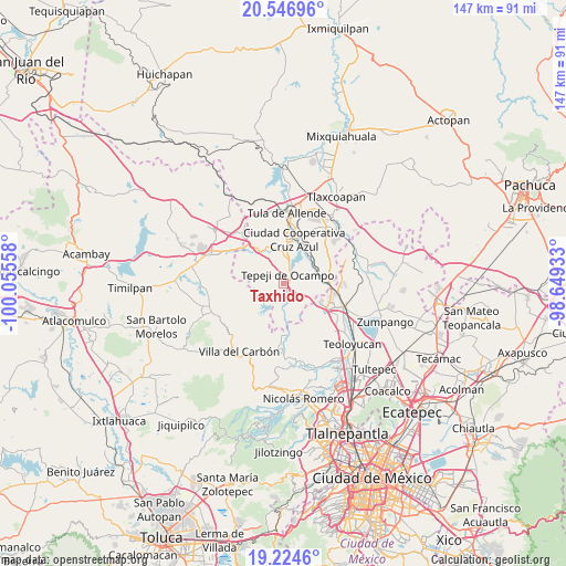
Taxhido GPS coordinates[2]
19° 53' 13.776" North, 99° 21' 8.82" West
| Map corner | latitude | longitude |
|---|---|---|
| Upper-left | 20.54696°, | -100.05558° |
| Center: | 19.88716°, | -99.35245° |
| Lower-right: | 19.2246°, | -98.64933° |
| Map W x H: | 147×147 km | = 91.3×91.3mi |
| max Lat: | 32.7° ⇑45.2% North |
| Taxhido: | 19.88716° |
| min Lat: | ⇓54.8% South 14.53588° |
| min Long | Taxhido | max Long |
| -117.105° | -99.35245° | -86.73105° |
| W 45%⇐ | ⇒55% E |
Elevation
Elevation of Taxhido is 2216 m = 7270 ft, and this is 962.3 m = 3157 ft above average elevation for this country.
| Max E: |
3497 m = 11473 ft | 17% |
| Taxhido | 2216 m 7270 ft | |
| Avg. | 1253.7 m = 4113 ft | |
Min E: |
-1 m = -3 ft | 83% |
See also: Mexico elevation on elevation.city.
Geographical zone
Taxhido is located in North Torrid zone (between Equator and Tropic of Cancer). Distance of this Northern Tropic circle is 394.7 km =245.3 mi to North.| Distance of | km | miles | from Taxhido |
|---|---|---|---|
| North Pole | 7795.8 | 4844.1 | to North |
| Arctic Circle | 5189.9 | 3224.9 | to North |
| Tropic Cancer | 394.7 | 245.3 | to North |
| Equator | 2211.2 | 1374 | to South |


Nearby cities:
15 places around Taxhido: (largest is in red/bold)
• Cantera de Villagrán
6.9 km =4.3 mi,  138°
138°
• Loma Alta Taxhimay
7.7 km =4.8 mi,  229°
229°
• San Buenaventura
8 km =5 mi,  156°
156°
• San Ignacio Nopala
5.8 km =3.6 mi,  172°
172°
• San José Piedra Gorda
9.2 km =5.7 mi,  185°
185°
• San Luis Taxhimay
7.2 km =4.5 mi,  222°
222°
• Santa Ana Azcapotzaltongo
7.3 km =4.5 mi,  329°
329°
• Santa María Quelites
3.7 km =2.3 mi, 172°
• Santiago Tlaltepoxco
9.6 km =6 mi,  92°
92°
• Santiago Tlapanaloya
1.9 km =1.2 mi, 174°
• Santiago Tlautla
8.5 km =5.3 mi,  348°
348°
• Tepeji del Río de Ocampo
2.2 km =1.4 mi,  24°
24°
• Tianguistengo (La Romera)
4.1 km =2.5 mi,  42°
42°
• Tinajas
1.9 km =1.2 mi,  307°
307°
• Unidad Obrera Habitacional CTM
5.3 km =3.3 mi, 39°
Sources, notices
• [Note1] Compared only with cities in Mexico existing in our database
• [Src1] Map data: © OpenStreetMap contributors (CC-BY-SA)
• [Src2] Other city data from geonames.org with taken over terms of usage.
• [Src3] Geographical zone / Annual Mean Temperature by Robert A. Rohde @ Wikipedia
