San Luis Taxhimay geodata
San Luis Taxhimay (State of Mexico) is a populated place; located in Mexico in America/Mexico_City (GMT-6) time zone. With population of 2,145 people, there are 4090 cities with bigger population in this country. Compared to other cities in Mexico, 53.7% of cities are located further ↓South; 55.6% of cities are located further →East and 84.3% of cities have lower elevation than San Luis Taxhimay. Note1


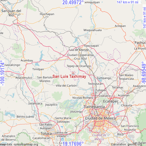
San Luis Taxhimay GPS coordinates[2]
19° 50' 22.992" North, 99° 23' 54.996" West
| Map corner | latitude | longitude |
|---|---|---|
| Upper-left | 20.49972°, | -100.10174° |
| Center: | 19.83972°, | -99.39861° |
| Lower-right: | 19.17696°, | -98.69549° |
| Map W x H: | 147.1×147.1 km | = 91.4×91.4mi |
| max Lat: | 32.7° ⇑46.3% North |
| San Luis Taxhimay: | 19.83972° |
| min Lat: | ⇓53.7% South 14.53588° |
| min Long | San Luis Taxhim | max Long |
| -117.105° | -99.39861° | -86.73105° |
| W 44.4%⇐ | ⇒55.6% E |
Elevation
Elevation of San Luis Taxhimay is 2248 m = 7375 ft, and this is 994.3 m = 3262 ft above average elevation for this country.
| Max E: |
3497 m = 11473 ft | 15.7% |
| San Luis Taxhimay | 2248 m 7375 ft | |
| Avg. | 1253.7 m = 4113 ft | |
Min E: |
-1 m = -3 ft | 84.3% |
See also: Mexico elevation on elevation.city.
Geographical zone
San Luis Taxhimay is located in North Torrid zone (between Equator and Tropic of Cancer). Distance of this Northern Tropic circle is 399.9 km =248.5 mi to North.| Distance of | km | miles | from San Luis Taxhimay |
|---|---|---|---|
| North Pole | 7801.1 | 4847.4 | to North |
| Arctic Circle | 5195.2 | 3228.1 | to North |
| Tropic Cancer | 399.9 | 248.5 | to North |
| Equator | 2206 | 1370.7 | to South |


Nearby cities:
15 places around San Luis Taxhimay: (largest is in red/bold)
• Cantera de Villagrán
9.4 km =5.8 mi,  89°
89°
• La Cruz y Carrizal
2.6 km =1.6 mi,  246°
246°
• La Loma
6.9 km =4.3 mi,  137°
137°
• Loma Alta Taxhimay
1 km =0.6 mi,  285°
285°
• San Buenaventura
8.3 km =5.2 mi,  104°
104°
• San Ignacio Nopala
5.6 km =3.5 mi, 95°
• San José Piedra Gorda
5.6 km =3.5 mi,  134°
134°
• San Luis Anáhuac (Toriles)
4.8 km =3 mi,  182°
182°
• Santa Ana Azcapotzaltongo
11.6 km =7.2 mi,  5°
5°
• Santa María Quelites
5.6 km =3.5 mi,  73°
73°
• Santiago Tlapanaloya
6.1 km =3.8 mi,  55°
55°
• Taxhido
7.2 km =4.5 mi,  42°
42°
• Tepeji del Río de Ocampo
9.2 km =5.7 mi, 38°
• Tianguistengo (La Romera)
11.2 km =7 mi, 42°
• Tinajas
7.2 km =4.5 mi,  27°
27°
Sources, notices
• [Note1] Compared only with cities in Mexico existing in our database
• [Src1] Map data: © OpenStreetMap contributors (CC-BY-SA)
• [Src2] Other city data from geonames.org with taken over terms of usage.
• [Src3] Geographical zone / Annual Mean Temperature by Robert A. Rohde @ Wikipedia
