Los Griegos geodata
Los Griegos (Zacatecas) is a populated place; located in Mexico in America/Mexico_City (GMT-6) time zone. With population of 733 people, there are 11918 cities with bigger population in this country. Compared to other cities in Mexico, 86.5% of cities are located further ↓South; 82.1% of cities are located further →East and 75.7% of cities have lower elevation than Los Griegos. Note1


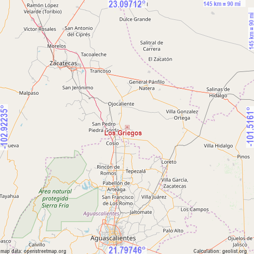
Los Griegos GPS coordinates[2]
22° 26' 55.716" North, 102° 13' 9.192" West
| Map corner | latitude | longitude |
|---|---|---|
| Upper-left | 23.09712°, | -102.92235° |
| Center: | 22.44881°, | -102.21922° |
| Lower-right: | 21.79746°, | -101.5161° |
| Map W x H: | 144.5×144.5 km | = 89.8×89.8mi |
| max Lat: | 32.7° ⇑13.5% North |
| Los Griegos: | 22.44881° |
| min Lat: | ⇓86.5% South 14.53588° |
| min Long | Los Griegos | max Long |
| -117.105° | -102.21922° | -86.73105° |
| W 17.9%⇐ | ⇒82.1% E |
Elevation
Elevation of Los Griegos is 2043 m = 6703 ft, and this is 789.3 m = 2590 ft above average elevation for this country.
| Max E: |
3497 m = 11473 ft | 24.3% |
| Los Griegos | 2043 m 6703 ft | |
| Avg. | 1253.7 m = 4113 ft | |
Min E: |
-1 m = -3 ft | 75.7% |
See also: Mexico elevation on elevation.city.
Geographical zone
Los Griegos is located in North Torrid zone (between Equator and Tropic of Cancer). Distance of this Northern Tropic circle is 109.8 km =68.2 mi to North.| Distance of | km | miles | from Los Griegos |
|---|---|---|---|
| North Pole | 7511 | 4667.1 | to North |
| Arctic Circle | 4905.1 | 3047.9 | to North |
| Tropic Cancer | 109.8 | 68.2 | to North |
| Equator | 2496.1 | 1551 | to South |


Nearby cities:
15 places around Los Griegos: (largest is in red/bold)
• Buenavista
3.4 km =2.1 mi,  123°
123°
• Colonia Hidalgo
6.8 km =4.2 mi,  342°
342°
• Colonia Veinte de Noviembre
8.8 km =5.5 mi,  312°
312°
• El Refugio de Agua Zarca
11.4 km =7.1 mi,  210°
210°
• El Refugio de Providencia (Providencia)
12 km =7.5 mi,  199°
199°
• Esteban S. Castorena
4.5 km =2.8 mi,  289°
289°
• Jarillas
11.3 km =7 mi,  10°
10°
• La Concepción
8.9 km =5.5 mi,  327°
327°
• Luis Moya
3.5 km =2.2 mi,  238°
238°
• Milagros
6.8 km =4.2 mi,  32°
32°
• San Jacinto
11.2 km =7 mi,  187°
187°
• San Juan de la Natura
9.6 km =6 mi,  181°
181°
• Santa María de la Paz
7.8 km =4.8 mi, 209°
• Soledad de Abajo
8.2 km =5.1 mi, 236°
• Soledad de Arriba
9.2 km =5.7 mi,  258°
258°
Sources, notices
• [Note1] Compared only with cities in Mexico existing in our database
• [Src1] Map data: © OpenStreetMap contributors (CC-BY-SA)
• [Src2] Other city data from geonames.org with taken over terms of usage.
• [Src3] Geographical zone / Annual Mean Temperature by Robert A. Rohde @ Wikipedia
