José María Morelos y Pavón geodata
José María Morelos y Pavón (Zacatecas) is a populated place; located in Mexico in America/Mexico_City (GMT-6) time zone. With population of 1,737 people, there are 4994 cities with bigger population in this country. Compared to other cities in Mexico, 89.6% of cities are located further ↓South; 86.3% of cities are located further →East and 71.4% of cities have lower elevation than José María Morelos y Pavón. Note1
Current local time in José María Morelos y Pavón:
08:34 AM, WednesdayDifference from your time zone: hours


José María Morelos y Pavón GPS coordinates[2]
23° 51' 46.368" North, 103° 8' 30.948" West
| Map corner | latitude | longitude |
|---|---|---|
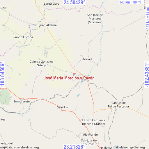
| Upper-left | 24.50429°, | -103.84506° |
| Center: | 23.86288°, | -103.14193° |
| Lower-right: | 23.21828°, | -102.43881° |
| Map W x H: | 143×143 km | = 88.9×88.9mi |
| max Lat: | 32.7° ⇑10.4% North |
| José María Morelos y Pavón: | 23.86288° |
| min Lat: | ⇓89.6% South 14.53588° |
| min Long | José María Mo | max Long |
| -117.105° | -103.14193° | -86.73105° |
| W 13.7%⇐ | ⇒86.3% E |
Elevation
Elevation of José María Morelos y Pavón is 1955 m = 6414 ft, and this is 701.3 m = 2301 ft above average elevation for this country.
| Max E: |
3497 m = 11473 ft | 28.6% |
| José María Morelos y Pavón | 1955 m 6414 ft | |
| Avg. | 1253.7 m = 4113 ft | |
Min E: |
-1 m = -3 ft | 71.4% |
See also: Mexico elevation on elevation.city.
Geographical zone
José María Morelos y Pavón is located in North temperate zone (between Tropic of Cancer and the Arctic Circle). Distance of this Northern Tropic circle is 47.4 km =29.5 mi to South.| Distance of | km | miles | from José María Morelos y Pavón |
|---|---|---|---|
| North Pole | 7353.8 | 4569.4 | to North |
| Arctic Circle | 4747.9 | 2950.2 | to North |
| Tropic Cancer | 47.4 | 29.5 | to South |
| Equator | 2653.3 | 1648.7 | to South |


Nearby cities:
15 places around José María Morelos y Pavón: (largest is in red/bold)
• Ciénega y Mancilla
10.6 km =6.6 mi,  137°
137°
• Colonia Francisco García Salinas
7.1 km =4.4 mi,  215°
215°
• El Fuerte
2.2 km =1.4 mi,  115°
115°
• Ignacio López Rayón (Los Delgado)
8.8 km =5.5 mi, 124°
• La Estanzuela
8.4 km =5.2 mi,  11°
11°
• La Florida
9.3 km =5.8 mi,  134°
134°
• Las Esperanzas (El Ranchito)
1.8 km =1.1 mi, 143°
• Las Piedras
10.5 km =6.5 mi, 130°
• Loreto
13.4 km =8.3 mi,  95°
95°
• Los Condes
7 km =4.3 mi,  112°
112°
• Los Ramírez
11.1 km =6.9 mi, 100°
• Pastelera
14 km =8.7 mi,  160°
160°
• Río Grande
12 km =7.5 mi, 109°
• San Felipe
9 km =5.6 mi, 157°
• Tierra Blanca
7.7 km =4.8 mi, 120°
Sources, notices
• [Note1] Compared only with cities in Mexico existing in our database
• [Src1] Map data: © OpenStreetMap contributors (CC-BY-SA)
• [Src2] Other city data from geonames.org with taken over terms of usage.
• [Src3] Geographical zone / Annual Mean Temperature by Robert A. Rohde @ Wikipedia
