Ciénega y Mancilla geodata
Ciénega y Mancilla (Zacatecas) is a populated place; located in Mexico in America/Mexico_City (GMT-6) time zone. With population of 728 people, there are 11990 cities with bigger population in this country. Compared to other cities in Mexico, 89.4% of cities are located further ↓South; 86% of cities are located further →East and 68% of cities have lower elevation than Ciénega y Mancilla. Note1


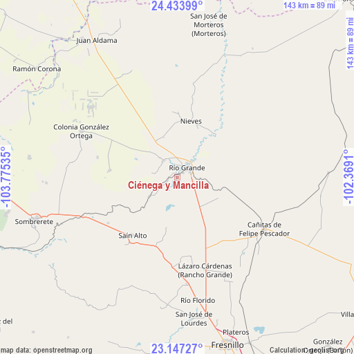
Ciénega y Mancilla GPS coordinates[2]
23° 47' 31.992" North, 103° 4' 19.992" West
| Map corner | latitude | longitude |
|---|---|---|
| Upper-left | 24.43399°, | -103.77535° |
| Center: | 23.79222°, | -103.07222° |
| Lower-right: | 23.14727°, | -102.3691° |
| Map W x H: | 143.1×143.1 km | = 88.9×88.9mi |
| max Lat: | 32.7° ⇑10.6% North |
| Ciénega y Mancilla: | 23.79222° |
| min Lat: | ⇓89.4% South 14.53588° |
| min Long | Ciénega y Manc | max Long |
| -117.105° | -103.07222° | -86.73105° |
| W 14%⇐ | ⇒86% E |
Elevation
Elevation of Ciénega y Mancilla is 1891 m = 6204 ft, and this is 637.3 m = 2091 ft above average elevation for this country.
| Max E: |
3497 m = 11473 ft | 32% |
| Ciénega y Mancilla | 1891 m 6204 ft | |
| Avg. | 1253.7 m = 4113 ft | |
Min E: |
-1 m = -3 ft | 68% |
See also: Mexico elevation on elevation.city.
Geographical zone
Ciénega y Mancilla is located in North temperate zone (between Tropic of Cancer and the Arctic Circle). Distance of this Northern Tropic circle is 39.5 km =24.5 mi to South.| Distance of | km | miles | from Ciénega y Mancilla |
|---|---|---|---|
| North Pole | 7361.6 | 4574.3 | to North |
| Arctic Circle | 4755.7 | 2955.1 | to North |
| Tropic Cancer | 39.5 | 24.5 | to South |
| Equator | 2645.4 | 1643.8 | to South |


Nearby cities:
15 places around Ciénega y Mancilla: (largest is in red/bold)
• Colonia Francisco García Salinas
11.3 km =7 mi,  280°
280°
• El Cazadero
14.3 km =8.9 mi,  200°
200°
• El Fuerte
8.6 km =5.3 mi,  323°
323°
• Ignacio López Rayón (Los Delgado)
2.8 km =1.7 mi,  2°
2°
• José María Morelos y Pavón
10.6 km =6.6 mi, 317°
• La Florida
1.5 km =0.9 mi,  342°
342°
• Las Esperanzas (El Ranchito)
8.8 km =5.5 mi, 316°
• Las Piedras
1.4 km =0.9 mi,  39°
39°
• Loreto
9 km =5.6 mi, 43°
• Los Condes
5.2 km =3.2 mi,  352°
352°
• Los Ramírez
7 km =4.3 mi,  33°
33°
• Pastelera
5.9 km =3.7 mi,  205°
205°
• Río Grande
5.7 km =3.5 mi,  48°
48°
• San Felipe
3.6 km =2.2 mi,  263°
263°
• Tierra Blanca
3.9 km =2.4 mi, 353°
Sources, notices
• [Note1] Compared only with cities in Mexico existing in our database
• [Src1] Map data: © OpenStreetMap contributors (CC-BY-SA)
• [Src2] Other city data from geonames.org with taken over terms of usage.
• [Src3] Geographical zone / Annual Mean Temperature by Robert A. Rohde @ Wikipedia
