Tanques geodata
Tanques (Sinaloa) is a populated place; located in Mexico in America/Mazatlan (GMT-7) time zone. With population of 1,652 people, there are 5251 cities with bigger population in this country. Compared to other cities in Mexico, 90.2% of cities are located further ↓South; 94.4% of cities are located further →East and 90% of cities have higher elevation than Tanques. Note1


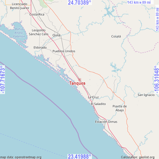
Tanques GPS coordinates[2]
24° 3' 48.564" North, 107° 0' 48.96" West
| Map corner | latitude | longitude |
|---|---|---|
| Upper-left | 24.70389°, | -107.71673° |
| Center: | 24.06349°, | -107.0136° |
| Lower-right: | 23.41988°, | -106.31048° |
| Map W x H: | 142.8×142.8 km | = 88.7×88.7mi |
| max Lat: | 32.7° ⇑9.8% North |
| Tanques: | 24.06349° |
| min Lat: | ⇓90.2% South 14.53588° |
| min Long | Tanques | max Long |
| -117.105° | -107.0136° | -86.73105° |
| W 5.6%⇐ | ⇒94.4% E |
Elevation
Elevation of Tanques is 24 m = 79 ft, and this is 1229.7 m = 4034 ft below average elevation for this country.
| Max E: |
3497 m = 11473 ft | 90% |
| Avg. | 1253.7 m = 4113 ft | |
| Tanques | 24 m = 79 ft | |
Min E: |
-1 m = -3 ft | 10% |
See also: Mexico elevation on elevation.city.
Geographical zone
Tanques is located in North temperate zone (between Tropic of Cancer and the Arctic Circle). Distance of this Northern Tropic circle is 69.7 km =43.3 mi to South.| Distance of | km | miles | from Tanques |
|---|---|---|---|
| North Pole | 7331.5 | 4555.6 | to North |
| Arctic Circle | 4725.6 | 2936.4 | to North |
| Tropic Cancer | 69.7 | 43.3 | to South |
| Equator | 2675.6 | 1662.5 | to South |


Nearby cities:
15 places around Tanques: (largest is in red/bold)
• Boscoso
4.6 km =2.9 mi,  147°
147°
• Ceuta
20.1 km =12.5 mi, 154°
• Chiqueritos
13.2 km =8.2 mi,  348°
348°
• Cospita
12.6 km =7.8 mi,  291°
291°
• Ejido Culiacán (Culiacancito)
6.9 km =4.3 mi,  193°
193°
• El Bolillo
20.3 km =12.6 mi,  104°
104°
• El Carrizo
17.3 km =10.7 mi,  108°
108°
• El Espinal
13.9 km =8.6 mi,  62°
62°
• Emiliano Zapata
9.2 km =5.7 mi,  90°
90°
• Empaque Tarriba
20 km =12.4 mi,  155°
155°
• Jacola
19.9 km =12.4 mi,  314°
314°
• La Cruz
20 km =12.4 mi,  142°
142°
• Potrerillo del Norote
6.2 km =3.9 mi, 139°
• Pueblo Nuevo
9.9 km =6.2 mi, 144°
• San José de Conitaca (Nuevo Conitaca)
14.7 km =9.1 mi, 64°
Sources, notices
• [Note1] Compared only with cities in Mexico existing in our database
• [Src1] Map data: © OpenStreetMap contributors (CC-BY-SA)
• [Src2] Other city data from geonames.org with taken over terms of usage.
• [Src3] Geographical zone / Annual Mean Temperature by Robert A. Rohde @ Wikipedia
