Cospita geodata
Cospita (Sinaloa) is a populated place; located in Mexico in America/Mazatlan (GMT-7) time zone. With population of 895 people, there are 9743 cities with bigger population in this country. Compared to other cities in Mexico, 90.3% of cities are located further ↓South; 94.5% of cities are located further →East and 99.6% of cities have higher elevation than Cospita. Note1


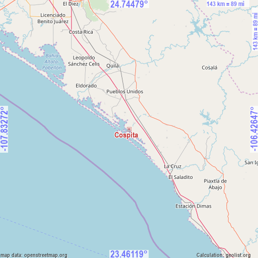
Cospita GPS coordinates[2]
24° 6' 16.56" North, 107° 7' 46.524" West
| Map corner | latitude | longitude |
|---|---|---|
| Upper-left | 24.74479°, | -107.83272° |
| Center: | 24.1046°, | -107.12959° |
| Lower-right: | 23.46119°, | -106.42647° |
| Map W x H: | 142.7×142.7 km | = 88.7×88.7mi |
| max Lat: | 32.7° ⇑9.7% North |
| Cospita: | 24.1046° |
| min Lat: | ⇓90.3% South 14.53588° |
| min Long | Cospita | max Long |
| -117.105° | -107.12959° | -86.73105° |
| W 5.5%⇐ | ⇒94.5% E |
Elevation
Elevation of Cospita is 4 m = 13 ft, and this is 1249.7 m = 4100 ft below average elevation for this country.
| Max E: |
3497 m = 11473 ft | 99.6% |
| Avg. | 1253.7 m = 4113 ft | |
| Cospita | 4 m = 13 ft | |
Min E: |
-1 m = -3 ft | 0.4% |
See also: Mexico elevation on elevation.city.
Geographical zone
Cospita is located in North temperate zone (between Tropic of Cancer and the Arctic Circle). Distance of this Northern Tropic circle is 74.3 km =46.2 mi to South.| Distance of | km | miles | from Cospita |
|---|---|---|---|
| North Pole | 7326.9 | 4552.7 | to North |
| Arctic Circle | 4721 | 2933.5 | to North |
| Tropic Cancer | 74.3 | 46.2 | to South |
| Equator | 2680.2 | 1665.4 | to South |


Nearby cities:
15 places around Cospita: (largest is in red/bold)
• Abuya y Ceuta Segunda (Ejido Echeverría)
15.7 km =9.8 mi,  354°
354°
• Boscoso
16.5 km =10.3 mi,  120°
120°
• Chiqueritos
12.4 km =7.7 mi,  47°
47°
• Colonia Emancipación
19.9 km =12.4 mi,  337°
337°
• Ejido Culiacán (Culiacancito)
15.2 km =9.4 mi,  137°
137°
• El Rosario
17.6 km =10.9 mi, 342°
• Emiliano Zapata
21.5 km =13.4 mi,  102°
102°
• Estación Obispo
21.2 km =13.2 mi, 351°
• Higueras de Abuya
18.3 km =11.4 mi,  18°
18°
• Jacola
9.7 km =6 mi, 346°
• Península de Villamoros
11.7 km =7.3 mi,  306°
306°
• Potrerillo del Norote
18.3 km =11.4 mi, 120°
• Pueblo Nuevo
21.6 km =13.4 mi,  125°
125°
• Pueblos Unidos
21 km =13 mi, 353°
• Tanques
12.6 km =7.8 mi,  111°
111°
Sources, notices
• [Note1] Compared only with cities in Mexico existing in our database
• [Src1] Map data: © OpenStreetMap contributors (CC-BY-SA)
• [Src2] Other city data from geonames.org with taken over terms of usage.
• [Src3] Geographical zone / Annual Mean Temperature by Robert A. Rohde @ Wikipedia
