Chihuahuita geodata
Chihuahuita (Sinaloa) is a populated place; located in Mexico in America/Mazatlan (GMT-7) time zone. With population of 2,306 people, there are 3823 cities with bigger population in this country. Compared to other cities in Mexico, 95.5% of cities are located further ↓South; 97.1% of cities are located further →East and 97% of cities have higher elevation than Chihuahuita. Note1


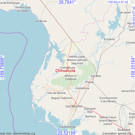
Chihuahuita GPS coordinates[2]
26° 9' 16.884" North, 109° 3' 17.856" West
| Map corner | latitude | longitude |
|---|---|---|
| Upper-left | 26.7841°, | -109.75809° |
| Center: | 26.15469°, | -109.05496° |
| Lower-right: | 25.52186°, | -108.35184° |
| Map W x H: | 140.3×140.3 km | = 87.2×87.2mi |
| max Lat: | 32.7° ⇑4.5% North |
| Chihuahuita: | 26.15469° |
| min Lat: | ⇓95.5% South 14.53588° |
| min Long | Chihuahuita | max Long |
| -117.105° | -109.05496° | -86.73105° |
| W 2.9%⇐ | ⇒97.1% E |
Elevation
Elevation of Chihuahuita is 10 m = 33 ft, and this is 1243.7 m = 4080 ft below average elevation for this country.
| Max E: |
3497 m = 11473 ft | 97% |
| Avg. | 1253.7 m = 4113 ft | |
| Chihuahuita | 10 m = 33 ft | |
Min E: |
-1 m = -3 ft | 3% |
See also: Mexico elevation on elevation.city.
Geographical zone
Chihuahuita is located in North temperate zone (between Tropic of Cancer and the Arctic Circle). Distance of this Northern Tropic circle is 302.2 km =187.8 mi to South.| Distance of | km | miles | from Chihuahuita |
|---|---|---|---|
| North Pole | 7098.9 | 4411.1 | to North |
| Arctic Circle | 4493 | 2791.8 | to North |
| Tropic Cancer | 302.2 | 187.8 | to South |
| Equator | 2908.1 | 1807 | to South |


Nearby cities:
15 places around Chihuahuita: (largest is in red/bold)
• Agiabampo Número Dos
19.3 km =12 mi,  347°
347°
• Alfonso G. Calderón (Poblado Siete)
10.5 km =6.5 mi,  160°
160°
• Bacorehuis
18.3 km =11.4 mi, 350°
• Bolsa de Tosalibampo Dos
14.7 km =9.1 mi,  246°
246°
• Bolsa de Tosalibampo Uno
12.7 km =7.9 mi, 247°
• Colonia 12 de Agosto
14 km =8.7 mi,  53°
53°
• Ejido Tosalibampo
20.2 km =12.6 mi,  196°
196°
• Jahuara Primero (Los Leyva)
22.1 km =13.7 mi,  139°
139°
• Jitzamuri
21.8 km =13.5 mi,  287°
287°
• Lázaro Cárdenas
20.7 km =12.9 mi,  38°
38°
• Nuevo San Miguel
21.3 km =13.2 mi,  179°
179°
• Palo Verde
21.6 km =13.4 mi, 35°
• Poblado Número Cinco
7.6 km =4.7 mi, 354°
• Revolución Mexicana
20.6 km =12.8 mi,  32°
32°
• Tepic
16.2 km =10.1 mi, 47°
Sources, notices
• [Note1] Compared only with cities in Mexico existing in our database
• [Src1] Map data: © OpenStreetMap contributors (CC-BY-SA)
• [Src2] Other city data from geonames.org with taken over terms of usage.
• [Src3] Geographical zone / Annual Mean Temperature by Robert A. Rohde @ Wikipedia
