Jahuara Primero (Los Leyva) geodata
Jahuara Primero (Los Leyva) (Sinaloa) is a populated place; located in Mexico in America/Mazatlan (GMT-7) time zone. With population of 532 people, there are 15923 cities with bigger population in this country. Compared to other cities in Mexico, 95.3% of cities are located further ↓South; 96.8% of cities are located further →East and 89% of cities have higher elevation than Jahuara Primero (Los Leyva). Note1
Current local time in Jahuara Primero (Los Leyva):
07:33 AM, WednesdayDifference from your time zone: hours


Jahuara Primero (Los Leyva) GPS coordinates[2]
26° 0' 10.008" North, 108° 54' 46.008" West
| Map corner | latitude | longitude |
|---|---|---|
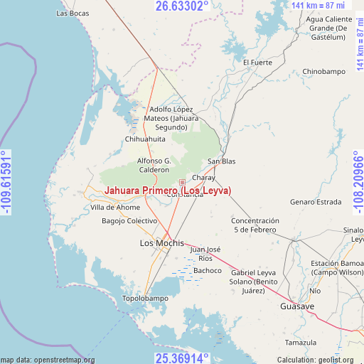
| Upper-left | 26.63302°, | -109.61591° |
| Center: | 26.00278°, | -108.91278° |
| Lower-right: | 25.36914°, | -108.20966° |
| Map W x H: | 140.5×140.5 km | = 87.3×87.3mi |
| max Lat: | 32.7° ⇑4.7% North |
| Jahuara Primero (Los Leyva): | 26.00278° |
| min Lat: | ⇓95.3% South 14.53588° |
| min Long | Jahuara Primero | max Long |
| -117.105° | -108.91278° | -86.73105° |
| W 3.2%⇐ | ⇒96.8% E |
Elevation
Elevation of Jahuara Primero (Los Leyva) is 27 m = 89 ft, and this is 1226.7 m = 4025 ft below average elevation for this country.
| Max E: |
3497 m = 11473 ft | 89% |
| Avg. | 1253.7 m = 4113 ft | |
| Jahuara Primero (Los Leyva) | 27 m = 89 ft | |
Min E: |
-1 m = -3 ft | 11% |
See also: Mexico elevation on elevation.city.
Geographical zone
Jahuara Primero (Los Leyva) is located in North temperate zone (between Tropic of Cancer and the Arctic Circle). Distance of this Northern Tropic circle is 285.3 km =177.3 mi to South.| Distance of | km | miles | from Jahuara Primero (Los Leyva) |
|---|---|---|---|
| North Pole | 7115.8 | 4421.6 | to North |
| Arctic Circle | 4509.9 | 2802.3 | to North |
| Tropic Cancer | 285.3 | 177.3 | to South |
| Equator | 2891.2 | 1796.5 | to South |


Nearby cities:
15 places around Jahuara Primero (Los Leyva): (largest is in red/bold)
• Benito Juárez (Vinatería)
5.1 km =3.2 mi,  129°
129°
• Camajoa
5.9 km =3.7 mi,  106°
106°
• Campo Seco (Tres de Mayo)
8.6 km =5.3 mi,  84°
84°
• Carricitos
3.5 km =2.2 mi,  211°
211°
• Charay
8.4 km =5.2 mi, 75°
• Constancia
4.7 km =2.9 mi,  163°
163°
• Dos de Abril
10.6 km =6.6 mi,  195°
195°
• El Pochotal
7 km =4.3 mi,  96°
96°
• El Ranchito
5.4 km =3.4 mi,  221°
221°
• Higueras de los Natoches
8.3 km =5.2 mi,  231°
231°
• Huepaco
5.6 km =3.5 mi, 111°
• Kilómetro 19
10.3 km =6.4 mi,  142°
142°
• La Palma
6.3 km =3.9 mi,  57°
57°
• Mochicahui
6 km =3.7 mi, 196°
• Taxtes
9.9 km =6.2 mi,  193°
193°
Sources, notices
• [Note1] Compared only with cities in Mexico existing in our database
• [Src1] Map data: © OpenStreetMap contributors (CC-BY-SA)
• [Src2] Other city data from geonames.org with taken over terms of usage.
• [Src3] Geographical zone / Annual Mean Temperature by Robert A. Rohde @ Wikipedia
