Villamoros geodata
Villamoros (Sinaloa) is a populated place; located in Mexico in America/Mazatlan (GMT-7) time zone. With population of 770 people, there are 11354 cities with bigger population in this country. Compared to other cities in Mexico, 91.2% of cities are located further ↓South; 95.2% of cities are located further →East and 97% of cities have higher elevation than Villamoros. Note1


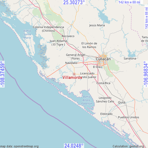
Villamoros GPS coordinates[2]
24° 39' 55.44" North, 107° 40' 17.256" West
| Map corner | latitude | longitude |
|---|---|---|
| Upper-left | 25.30273°, | -108.37459° |
| Center: | 24.6654°, | -107.67146° |
| Lower-right: | 24.0248°, | -106.96834° |
| Map W x H: | 142.1×142.1 km | = 88.3×88.3mi |
| max Lat: | 32.7° ⇑8.8% North |
| Villamoros: | 24.6654° |
| min Lat: | ⇓91.2% South 14.53588° |
| min Long | Villamoros | max Long |
| -117.105° | -107.67146° | -86.73105° |
| W 4.8%⇐ | ⇒95.2% E |
Elevation
Elevation of Villamoros is 10 m = 33 ft, and this is 1243.7 m = 4080 ft below average elevation for this country.
| Max E: |
3497 m = 11473 ft | 97% |
| Avg. | 1253.7 m = 4113 ft | |
| Villamoros | 10 m = 33 ft | |
Min E: |
-1 m = -3 ft | 3% |
See also: Mexico elevation on elevation.city.
Geographical zone
Villamoros is located in North temperate zone (between Tropic of Cancer and the Arctic Circle). Distance of this Northern Tropic circle is 136.6 km =84.9 mi to South.| Distance of | km | miles | from Villamoros |
|---|---|---|---|
| North Pole | 7264.5 | 4513.9 | to North |
| Arctic Circle | 4658.6 | 2894.7 | to North |
| Tropic Cancer | 136.6 | 84.9 | to South |
| Equator | 2742.5 | 1704.1 | to South |


Nearby cities:
15 places around Villamoros: (largest is in red/bold)
• Aguapepito
7.9 km =4.9 mi,  182°
182°
• Bachimeto
11.2 km =7 mi,  319°
319°
• Colonia Michoacana
7.7 km =4.8 mi,  31°
31°
• Colonia Michoacana (Luis Vélez)
6.2 km =3.9 mi,  89°
89°
• Ejido Convención de Aguascalientes
11 km =6.8 mi,  20°
20°
• El Molino
10.5 km =6.5 mi, 176°
• El Potrero de Sataya
4.7 km =2.9 mi,  305°
305°
• Iraguato
4.5 km =2.8 mi,  172°
172°
• La Curva (La Curva de San Pedro)
10.2 km =6.3 mi,  48°
48°
• La Vuelta
6.5 km =4 mi,  327°
327°
• Las Trancas
9.1 km =5.7 mi, 307°
• Otameto
9.9 km =6.2 mi, 315°
• Rosa Morada
2.1 km =1.3 mi,  291°
291°
• Sataya
4.5 km =2.8 mi,  159°
159°
• Tabolato
10.9 km =6.8 mi, 330°
Sources, notices
• [Note1] Compared only with cities in Mexico existing in our database
• [Src1] Map data: © OpenStreetMap contributors (CC-BY-SA)
• [Src2] Other city data from geonames.org with taken over terms of usage.
• [Src3] Geographical zone / Annual Mean Temperature by Robert A. Rohde @ Wikipedia
