Otameto geodata
Otameto (Sinaloa) is a populated place; located in Mexico in America/Mazatlan (GMT-7) time zone. With population of 664 people, there are 13077 cities with bigger population in this country. Compared to other cities in Mexico, 91.3% of cities are located further ↓South; 95.3% of cities are located further →East and 94% of cities have higher elevation than Otameto. Note1


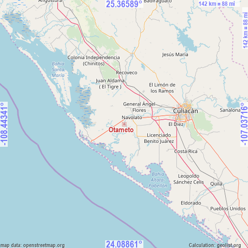
Otameto GPS coordinates[2]
24° 43' 44.004" North, 107° 44' 25.008" West
| Map corner | latitude | longitude |
|---|---|---|
| Upper-left | 25.36589°, | -108.44341° |
| Center: | 24.72889°, | -107.74028° |
| Lower-right: | 24.08861°, | -107.03716° |
| Map W x H: | 142×142 km | = 88.2×88.2mi |
| max Lat: | 32.7° ⇑8.7% North |
| Otameto: | 24.72889° |
| min Lat: | ⇓91.3% South 14.53588° |
| min Long | Otameto | max Long |
| -117.105° | -107.74028° | -86.73105° |
| W 4.7%⇐ | ⇒95.3% E |
Elevation
Elevation of Otameto is 15 m = 49 ft, and this is 1238.7 m = 4064 ft below average elevation for this country.
| Max E: |
3497 m = 11473 ft | 94% |
| Avg. | 1253.7 m = 4113 ft | |
| Otameto | 15 m = 49 ft | |
Min E: |
-1 m = -3 ft | 6% |
See also: Mexico elevation on elevation.city.
Geographical zone
Otameto is located in North temperate zone (between Tropic of Cancer and the Arctic Circle). Distance of this Northern Tropic circle is 143.7 km =89.3 mi to South.| Distance of | km | miles | from Otameto |
|---|---|---|---|
| North Pole | 7257.5 | 4509.6 | to North |
| Arctic Circle | 4651.6 | 2890.4 | to North |
| Tropic Cancer | 143.7 | 89.3 | to South |
| Equator | 2749.6 | 1708.5 | to South |


Nearby cities:
15 places around Otameto: (largest is in red/bold)
• Bachimeto
1.5 km =0.9 mi,  345°
345°
• Bachoco
9.7 km =6 mi,  318°
318°
• Bariometo
8.9 km =5.5 mi,  61°
61°
• Cofradía de Navolato (Cofradía de los Rocha)
10.3 km =6.4 mi, 64°
• El Potrero de Sataya
5.3 km =3.3 mi,  143°
143°
• El Vergel
6.1 km =3.8 mi,  257°
257°
• Ezequiel Leyva (Tacuache)
5.8 km =3.6 mi,  253°
253°
• La Vuelta
3.8 km =2.4 mi,  114°
114°
• Las Trancas
1.6 km =1 mi,  189°
189°
• Licenciado Alfredo Valdez Montoya
8.8 km =5.5 mi, 250°
• Lo de Reyes
4.6 km =2.9 mi, 317°
• Navolato
5.6 km =3.5 mi,  42°
42°
• Rosa Morada
8 km =5 mi, 141°
• Tabolato
3 km =1.9 mi,  33°
33°
• Villamoros
9.9 km =6.2 mi, 135°
Sources, notices
• [Note1] Compared only with cities in Mexico existing in our database
• [Src1] Map data: © OpenStreetMap contributors (CC-BY-SA)
• [Src2] Other city data from geonames.org with taken over terms of usage.
• [Src3] Geographical zone / Annual Mean Temperature by Robert A. Rohde @ Wikipedia
