Uruétaro geodata
Uruétaro (Guanajuato) is a populated place; located in Mexico in America/Mexico_City (GMT-6) time zone. With population of 831 people, there are 10527 cities with bigger population in this country. Compared to other cities in Mexico, 68.2% of cities are located further ↓South; 74.8% of cities are located further →East and 59.6% of cities have lower elevation than Uruétaro. Note1


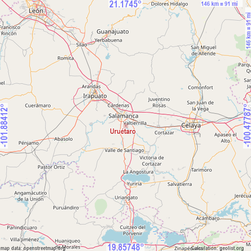
Uruétaro GPS coordinates[2]
20° 31' 2.676" North, 101° 10' 51.564" West
| Map corner | latitude | longitude |
|---|---|---|
| Upper-left | 21.1745°, | -101.88412° |
| Center: | 20.51741°, | -101.18099° |
| Lower-right: | 19.85748°, | -100.47787° |
| Map W x H: | 146.4×146.4 km | = 91×91mi |
| max Lat: | 32.7° ⇑31.8% North |
| Uruétaro: | 20.51741° |
| min Lat: | ⇓68.2% South 14.53588° |
| min Long | Uruétaro | max Long |
| -117.105° | -101.18099° | -86.73105° |
| W 25.2%⇐ | ⇒74.8% E |
Elevation
Elevation of Uruétaro is 1719 m = 5640 ft, and this is 465.3 m = 1527 ft above average elevation for this country.
| Max E: |
3497 m = 11473 ft | 40.4% |
| Uruétaro | 1719 m 5640 ft | |
| Avg. | 1253.7 m = 4113 ft | |
Min E: |
-1 m = -3 ft | 59.6% |
See also: Mexico elevation on elevation.city.
Geographical zone
Uruétaro is located in North Torrid zone (between Equator and Tropic of Cancer). Distance of this Northern Tropic circle is 324.6 km =201.7 mi to North.| Distance of | km | miles | from Uruétaro |
|---|---|---|---|
| North Pole | 7725.7 | 4800.5 | to North |
| Arctic Circle | 5119.9 | 3181.4 | to North |
| Tropic Cancer | 324.6 | 201.7 | to North |
| Equator | 2281.3 | 1417.5 | to South |


Nearby cities:
15 places around Uruétaro: (largest is in red/bold)
• Callejones y Granados
6.9 km =4.3 mi,  229°
229°
• Cerro Gordo
10.1 km =6.3 mi,  33°
33°
• El Divisador
7.1 km =4.4 mi,  19°
19°
• La Luz
4.1 km =2.5 mi,  0°
0°
• La Tinaja
4.7 km =2.9 mi, 230°
• Labor de Valtierra
8.2 km =5.1 mi,  247°
247°
• Los Lobos
5.2 km =3.2 mi,  202°
202°
• Palo Blanco
2.9 km =1.8 mi, 248°
• Puerto de Valle
5.8 km =3.6 mi,  123°
123°
• Rancho Seco de Guantes
7.7 km =4.8 mi, 198°
• Salamanca
6.2 km =3.9 mi,  349°
349°
• San Bernardo
10 km =6.2 mi, 119°
• San Juan de Razos
6.4 km =4 mi,  310°
310°
• Santo Domingo
5 km =3.1 mi,  268°
268°
• Valtierrilla
5.8 km =3.6 mi,  73°
73°
Sources, notices
• [Note1] Compared only with cities in Mexico existing in our database
• [Src1] Map data: © OpenStreetMap contributors (CC-BY-SA)
• [Src2] Other city data from geonames.org with taken over terms of usage.
• [Src3] Geographical zone / Annual Mean Temperature by Robert A. Rohde @ Wikipedia
