La Luz geodata
La Luz (Guanajuato) is a populated place; located in Mexico in America/Mexico_City (GMT-6) time zone. With population of 2,345 people, there are 3765 cities with bigger population in this country. Compared to other cities in Mexico, 69% of cities are located further ↓South; 74.8% of cities are located further →East and 59.4% of cities have lower elevation than La Luz. Note1


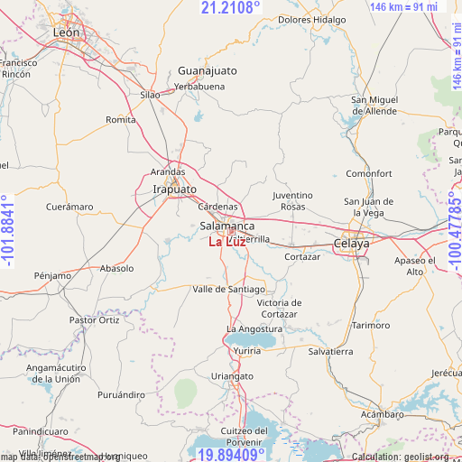
La Luz GPS coordinates[2]
20° 33' 13.896" North, 101° 10' 51.492" West
| Map corner | latitude | longitude |
|---|---|---|
| Upper-left | 21.2108°, | -101.8841° |
| Center: | 20.55386°, | -101.18097° |
| Lower-right: | 19.89409°, | -100.47785° |
| Map W x H: | 146.4×146.4 km | = 91×91mi |
| max Lat: | 32.7° ⇑31% North |
| La Luz: | 20.55386° |
| min Lat: | ⇓69% South 14.53588° |
| min Long | La Luz | max Long |
| -117.105° | -101.18097° | -86.73105° |
| W 25.2%⇐ | ⇒74.8% E |
Elevation
Elevation of La Luz is 1717 m = 5633 ft, and this is 463.3 m = 1520 ft above average elevation for this country.
| Max E: |
3497 m = 11473 ft | 40.6% |
| La Luz | 1717 m 5633 ft | |
| Avg. | 1253.7 m = 4113 ft | |
Min E: |
-1 m = -3 ft | 59.4% |
See also: Mexico elevation on elevation.city.
Geographical zone
La Luz is located in North Torrid zone (between Equator and Tropic of Cancer). Distance of this Northern Tropic circle is 320.5 km =199.1 mi to North.| Distance of | km | miles | from La Luz |
|---|---|---|---|
| North Pole | 7721.7 | 4798 | to North |
| Arctic Circle | 5115.8 | 3178.8 | to North |
| Tropic Cancer | 320.5 | 199.1 | to North |
| Equator | 2285.4 | 1420.1 | to South |


Nearby cities:
15 places around La Luz: (largest is in red/bold)
• Cerro Gordo
7.1 km =4.4 mi,  52°
52°
• Cárdenas
9.4 km =5.8 mi,  334°
334°
• El Divisador
3.5 km =2.2 mi,  42°
42°
• La Tinaja
7.9 km =4.9 mi,  206°
206°
• Los Lobos
9.1 km =5.7 mi,  192°
192°
• Los Prietos
9.1 km =5.7 mi,  285°
285°
• Oteros
6.7 km =4.2 mi,  8°
8°
• Palo Blanco
5.8 km =3.6 mi, 207°
• Puerto de Valle
8.7 km =5.4 mi,  146°
146°
• Salamanca
2.3 km =1.4 mi, 331°
• San Juan de Razos
4.9 km =3 mi,  271°
271°
• Santo Domingo
6.5 km =4 mi,  229°
229°
• Uruétaro
4.1 km =2.5 mi,  180°
180°
• Valtierrilla
6 km =3.7 mi,  113°
113°
• Zapote de Palomas
7.7 km =4.8 mi,  63°
63°
Sources, notices
• [Note1] Compared only with cities in Mexico existing in our database
• [Src1] Map data: © OpenStreetMap contributors (CC-BY-SA)
• [Src2] Other city data from geonames.org with taken over terms of usage.
• [Src3] Geographical zone / Annual Mean Temperature by Robert A. Rohde @ Wikipedia
