Rancho Seco de Guantes geodata
Rancho Seco de Guantes (Guanajuato) is a populated place; located in Mexico in America/Mexico_City (GMT-6) time zone. With population of 902 people, there are 9667 cities with bigger population in this country. Compared to other cities in Mexico, 66.7% of cities are located further ↓South; 75% of cities are located further →East and 60.2% of cities have lower elevation than Rancho Seco de Guantes. Note1
Current local time in Rancho Seco de Guantes:
08:28 AM, WednesdayDifference from your time zone: hours


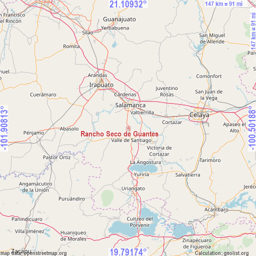
Rancho Seco de Guantes GPS coordinates[2]
20° 27' 6.984" North, 101° 12' 18" West
| Map corner | latitude | longitude |
|---|---|---|
| Upper-left | 21.10932°, | -101.90813° |
| Center: | 20.45194°, | -101.205° |
| Lower-right: | 19.79174°, | -100.50188° |
| Map W x H: | 146.5×146.5 km | = 91×91mi |
| max Lat: | 32.7° ⇑33.3% North |
| Rancho Seco de Guantes: | 20.45194° |
| min Lat: | ⇓66.7% South 14.53588° |
| min Long | Rancho Seco de | max Long |
| -117.105° | -101.205° | -86.73105° |
| W 25%⇐ | ⇒75% E |
Elevation
Elevation of Rancho Seco de Guantes is 1728 m = 5669 ft, and this is 474.3 m = 1556 ft above average elevation for this country.
| Max E: |
3497 m = 11473 ft | 39.8% |
| Rancho Seco de Guantes | 1728 m 5669 ft | |
| Avg. | 1253.7 m = 4113 ft | |
Min E: |
-1 m = -3 ft | 60.2% |
See also: Mexico elevation on elevation.city.
Geographical zone
Rancho Seco de Guantes is located in North Torrid zone (between Equator and Tropic of Cancer). Distance of this Northern Tropic circle is 331.9 km =206.2 mi to North.| Distance of | km | miles | from Rancho Seco de Guantes |
|---|---|---|---|
| North Pole | 7733 | 4805.1 | to North |
| Arctic Circle | 5127.1 | 3185.8 | to North |
| Tropic Cancer | 331.9 | 206.2 | to North |
| Equator | 2274 | 1413 | to South |


Nearby cities:
15 places around Rancho Seco de Guantes: (largest is in red/bold)
• Callejones y Granados
3.9 km =2.4 mi,  315°
315°
• La Tinaja
4.4 km =2.7 mi,  345°
345°
• Labor de Valtierra
6.5 km =4 mi,  309°
309°
• Los Lobos
2.5 km =1.6 mi,  11°
11°
• Palo Blanco
6.2 km =3.9 mi,  358°
358°
• Puerto de Valle
8.4 km =5.2 mi,  60°
60°
• Rincón de Parangueo
5.8 km =3.6 mi,  235°
235°
• San Isidro de Mogotes
7.9 km =4.9 mi,  247°
247°
• San Nicolás Parangueo
8.2 km =5.1 mi,  217°
217°
• San Nicolás Quiriceo
8.6 km =5.3 mi,  271°
271°
• San Vicente de Garma (Garma)
2.8 km =1.7 mi,  191°
191°
• Santo Domingo
7.5 km =4.7 mi,  341°
341°
• Uruétaro
7.7 km =4.8 mi,  18°
18°
• Valle de Santiago
6.9 km =4.3 mi,  168°
168°
• Zapote de San Vicente
3.2 km =2 mi, 247°
Sources, notices
• [Note1] Compared only with cities in Mexico existing in our database
• [Src1] Map data: © OpenStreetMap contributors (CC-BY-SA)
• [Src2] Other city data from geonames.org with taken over terms of usage.
• [Src3] Geographical zone / Annual Mean Temperature by Robert A. Rohde @ Wikipedia
