Tayoltita geodata
Tayoltita (Durango) is a populated place; located in Mexico in America/Mazatlan (GMT-7) time zone. With population of 5,124 people, there are 1811 cities with bigger population in this country. Compared to other cities in Mexico, 90.3% of cities are located further ↓South; 93.7% of cities are located further →East and 67.9% of cities have higher elevation than Tayoltita. Note1


Tayoltita GPS coordinates[2]
24° 6' 10.008" North, 105° 55' 50.988" West
| Map corner | latitude | longitude |
|---|---|---|
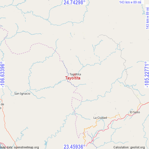
| Upper-left | 24.74298°, | -106.63396° |
| Center: | 24.10278°, | -105.93083° |
| Lower-right: | 23.45936°, | -105.22771° |
| Map W x H: | 142.7×142.7 km | = 88.7×88.7mi |
| max Lat: | 32.7° ⇑9.7% North |
| Tayoltita: | 24.10278° |
| min Lat: | ⇓90.3% South 14.53588° |
| min Long | Tayoltita | max Long |
| -117.105° | -105.93083° | -86.73105° |
| W 6.3%⇐ | ⇒93.7% E |
Elevation
Elevation of Tayoltita is 536 m = 1759 ft, and this is 717.7 m = 2355 ft below average elevation for this country.
| Max E: |
3497 m = 11473 ft | 67.9% |
| Avg. | 1253.7 m = 4113 ft | |
| Tayoltita | 536 m = 1759 ft | |
Min E: |
-1 m = -3 ft | 32.1% |
See also: Mexico elevation on elevation.city.
Geographical zone
Tayoltita is located in North temperate zone (between Tropic of Cancer and the Arctic Circle). Distance of this Northern Tropic circle is 74.1 km =46 mi to South.| Distance of | km | miles | from Tayoltita |
|---|---|---|---|
| North Pole | 7327.1 | 4552.8 | to North |
| Arctic Circle | 4721.2 | 2933.6 | to North |
| Tropic Cancer | 74.1 | 46 | to South |
| Equator | 2680 | 1665.3 | to South |


Nearby cities:
15 places around Tayoltita: (largest is in red/bold)
• Banderas del Águila
63.2 km =39.3 mi,  108°
108°
• Chavarría Nuevo
61.1 km =38 mi,  145°
145°
• El Mil Diez
64.6 km =40.1 mi,  121°
121°
• El Palmito
60.8 km =37.8 mi,  171°
171°
• El Salto
68.2 km =42.4 mi, 122°
• El Tecomate de la Noria
49.6 km =30.8 mi,  192°
192°
• Estación Coyotes (José María Morelos)
68 km =42.3 mi, 113°
• La Ciudad
48.1 km =29.9 mi, 149°
• Otaéz
66.8 km =41.5 mi,  354°
354°
• Potrerillos
73 km =45.4 mi, 171°
• San Ignacio
53.3 km =33.1 mi,  250°
250°
• San Jerónimo
50.9 km =31.6 mi,  129°
129°
• San Juan
47.1 km =29.3 mi,  238°
238°
• San Miguel de Cruces
35.6 km =22.1 mi,  14°
14°
• Vencedores
42.4 km =26.3 mi,  31°
31°
Sources, notices
• [Note1] Compared only with cities in Mexico existing in our database
• [Src1] Map data: © OpenStreetMap contributors (CC-BY-SA)
• [Src2] Other city data from geonames.org with taken over terms of usage.
• [Src3] Geographical zone / Annual Mean Temperature by Robert A. Rohde @ Wikipedia
