Chavarría Nuevo geodata
Chavarría Nuevo (Durango) is a populated place; located in Mexico in America/Monterrey (GMT-6) time zone. With population of 506 people, there are 16626 cities with bigger population in this country. Compared to other cities in Mexico, 89.2% of cities are located further ↓South; 93.4% of cities are located further →East and 71.3% of cities have lower elevation than Chavarría Nuevo. Note1


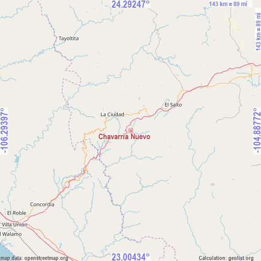
Chavarría Nuevo GPS coordinates[2]
23° 38' 59.964" North, 105° 35' 27.024" West
| Map corner | latitude | longitude |
|---|---|---|
| Upper-left | 24.29247°, | -106.29397° |
| Center: | 23.64999°, | -105.59084° |
| Lower-right: | 23.00434°, | -104.88772° |
| Map W x H: | 143.2×143.2 km | = 89×89mi |
| max Lat: | 32.7° ⇑10.8% North |
| Chavarría Nuevo: | 23.64999° |
| min Lat: | ⇓89.2% South 14.53588° |
| min Long | Chavarría Nuev | max Long |
| -117.105° | -105.59084° | -86.73105° |
| W 6.6%⇐ | ⇒93.4% E |
Elevation
Elevation of Chavarría Nuevo is 1951 m = 6401 ft, and this is 697.3 m = 2288 ft above average elevation for this country.
| Max E: |
3497 m = 11473 ft | 28.7% |
| Chavarría Nuevo | 1951 m 6401 ft | |
| Avg. | 1253.7 m = 4113 ft | |
Min E: |
-1 m = -3 ft | 71.3% |
See also: Mexico elevation on elevation.city.
Geographical zone
Chavarría Nuevo is located in North temperate zone (between Tropic of Cancer and the Arctic Circle). Distance of this Northern Tropic circle is 23.7 km =14.7 mi to South.| Distance of | km | miles | from Chavarría Nuevo |
|---|---|---|---|
| North Pole | 7377.4 | 4584.1 | to North |
| Arctic Circle | 4771.5 | 2964.9 | to North |
| Tropic Cancer | 23.7 | 14.7 | to South |
| Equator | 2629.6 | 1634 | to South |


Nearby cities:
15 places around Chavarría Nuevo: (largest is in red/bold)
• Banderas del Águila
39.9 km =24.8 mi,  39°
39°
• Copala
45 km =28 mi,  230°
230°
• El Mil Diez
26.5 km =16.5 mi,  51°
51°
• El Palmito
27 km =16.8 mi,  248°
248°
• El Salto
27.3 km =17 mi,  58°
58°
• El Tecomate de la Noria
45.6 km =28.3 mi,  272°
272°
• Estación Coyotes (José María Morelos)
36.8 km =22.9 mi, 49°
• La Ciudad
13.4 km =8.3 mi,  311°
311°
• La Petaca
33 km =20.5 mi,  221°
221°
• La Peña
23.6 km =14.7 mi,  112°
112°
• Mesa de San Pedro
28.7 km =17.8 mi,  181°
181°
• Potrerillos
32.6 km =20.3 mi, 227°
• Pueblo Nuevo
36.8 km =22.9 mi,  144°
144°
• San Jerónimo
18.5 km =11.5 mi,  14°
14°
• Santa Lucía
35.7 km =22.2 mi, 228°
Sources, notices
• [Note1] Compared only with cities in Mexico existing in our database
• [Src1] Map data: © OpenStreetMap contributors (CC-BY-SA)
• [Src2] Other city data from geonames.org with taken over terms of usage.
• [Src3] Geographical zone / Annual Mean Temperature by Robert A. Rohde @ Wikipedia
