Saucillo geodata
Saucillo (Chihuahua) is a seat of a second-order administrative division; located in Mexico in America/Chihuahua (GMT-6) time zone. With population of 11,004 people, there are 864 cities with bigger population in this country. Compared to other cities in Mexico, 97.3% of cities are located further ↓South; 92.6% of cities are located further →East and 55.2% of cities have higher elevation than Saucillo. Note1


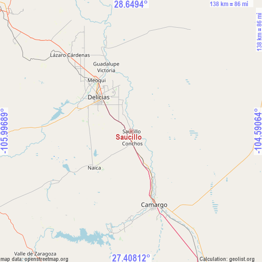
Saucillo GPS coordinates[2]
28° 1' 49.98" North, 105° 17' 37.536" West
| Map corner | latitude | longitude |
|---|---|---|
| Upper-left | 28.6494°, | -105.99689° |
| Center: | 28.03055°, | -105.29376° |
| Lower-right: | 27.40812°, | -104.59064° |
| Map W x H: | 138×138 km | = 85.7×85.7mi |
| max Lat: | 32.7° ⇑2.7% North |
| Saucillo: | 28.03055° |
| min Lat: | ⇓97.3% South 14.53588° |
| min Long | Saucillo | max Long |
| -117.105° | -105.29376° | -86.73105° |
| W 7.4%⇐ | ⇒92.6% E |
Elevation
Elevation of Saucillo is 1190 m = 3904 ft, and this is 63.7 m = 209 ft below average elevation for this country.
| Max E: |
3497 m = 11473 ft | 55.2% |
| Avg. | 1253.7 m = 4113 ft | |
| Saucillo | 1190 m = 3904 ft | |
Min E: |
-1 m = -3 ft | 44.8% |
See also: Mexico elevation on elevation.city.
Geographical zone
Saucillo is located in North temperate zone (between Tropic of Cancer and the Arctic Circle). Distance of this Northern Tropic circle is 510.8 km =317.4 mi to South.| Distance of | km | miles | from Saucillo |
|---|---|---|---|
| North Pole | 6890.4 | 4281.5 | to North |
| Arctic Circle | 4284.5 | 2662.3 | to North |
| Tropic Cancer | 510.8 | 317.4 | to South |
| Equator | 3116.7 | 1936.6 | to South |


Nearby cities:
15 places around Saucillo: (largest is in red/bold)
• Alvareñas
11.3 km =7 mi,  337°
337°
• Ciudad Delicias
24.8 km =15.4 mi,  315°
315°
• Colonia Abraham González (La Quemada)
22.5 km =14 mi,  330°
330°
• Colonia Nicolás Bravo (Kilómetro Noventa y Dos)
24 km =14.9 mi,  286°
286°
• Colonia Vicente Guerrero
2.1 km =1.3 mi,  279°
279°
• Colonia Vicente Guerrero
22.8 km =14.2 mi, 324°
• Estación Conchos
6.4 km =4 mi,  175°
175°
• Estación Saucillo
2.4 km =1.5 mi,  256°
256°
• La Cruz
20.9 km =13 mi,  152°
152°
• Las Varas
14.7 km =9.1 mi, 341°
• Loma Chica
10.6 km =6.6 mi, 332°
• Miguel Hidalgo
16.8 km =10.4 mi, 324°
• Orranteño
17.5 km =10.9 mi,  345°
345°
• Parritas
7.5 km =4.7 mi,  127°
127°
• Valle del Toro
10.4 km =6.5 mi,  140°
140°
Sources, notices
• [Note1] Compared only with cities in Mexico existing in our database
• [Src1] Map data: © OpenStreetMap contributors (CC-BY-SA)
• [Src2] Other city data from geonames.org with taken over terms of usage.
• [Src3] Geographical zone / Annual Mean Temperature by Robert A. Rohde @ Wikipedia
